Liberta (Liberta)
Liberta is a town located in Saint Paul Parish, on the island of Antigua in Antigua and Barbuda. It had a population of 2,560 in 2001.
It the fourth-largest town on Antigua. It is located in the southern island area, north of Falmouth Harbour and the port of Falmouth, to which it is connected by road.
Around the time of the 19th century British emancipation of slaves in British Antigua and Barbuda, a colonial plantation owner had financial troubles and was forced to sell off a part of her property in small lots. The ex-slaves in the neighbourhood bought up all the small freeholds, as they desired to own land in perpetuity. “Liberta”, meaning liberty and honoring the freed people, became the settlement's name in 1835. By 1842, a painted signboard near its border read: “The Village of Liberta”.
The new landowners immediately settled on the lots they had purchased, framed their houses, and cultivated their gardens. Besides working on nearby plantations, income was sometimes also earned working as mechanics at Nelson's Dockyard at Falmouth Harbour. Later on, their descendants also worked in other trades, such as tailors and shop keepers.
Map - Liberta (Liberta)
Map
Country - Antigua_and_Barbuda
 |
 |
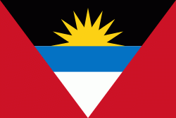
| Flag of Antigua and Barbuda | |
The country consists of two major islands, Antigua and Barbuda, which are approximately 40 km apart, and several smaller islands, including Great Bird, Green, Guiana, Long, Maiden, Prickly Pear, York, and Redonda. The permanent population is approximately 97,120 ( estimates), with 97% residing in Antigua. St. John's, Antigua, is the country's capital, major city, and largest port. Codrington is Barbuda's largest town.
Currency / Language
| ISO | Currency | Symbol | Significant figures |
|---|---|---|---|
| XCD | East Caribbean dollar | $ | 2 |
| ISO | Language |
|---|---|
| EN | English language |


