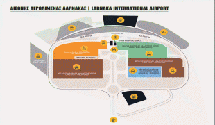
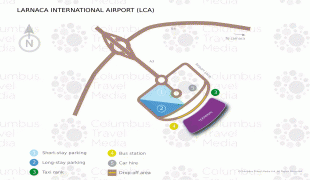
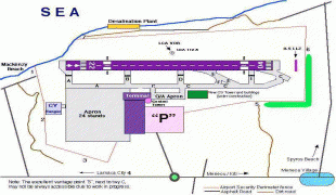
Larnaca International Airport (Larnaca International Airport)
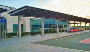
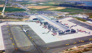
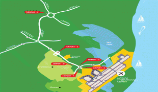
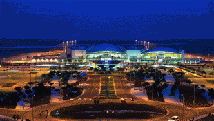
Larnaca International Airport – Glafcos Clerides is an international airport located 4 km southwest of Larnaca, Cyprus. Larnaca International Airport is Cyprus' main international gateway and the larger of the two commercial airports in the area controlled by the Republic of Cyprus, the other being Paphos International Airport on the island's southwestern coast. The airport was given its current name in July 2016, in honour of former President of Cyprus (1993 – 2003) Glafcos Clerides.
Larnaca Airport was hastily developed towards the end of 1974 after the invasion of Cyprus by Turkey on 20 July of the same year, which forced the closure of the Nicosia International Airport. The site on which it was built (near the Larnaca Salt Lake) had been previously used as an airfield in the 1930s and, subsequently, as a military installation by British forces. Larnaca International opened on 8 February 1975, with only limited infrastructure facilities and a prefabricated set of buildings comprising separate halls for departures and arrivals. The first airlines to use the new airport were Cyprus Airways, using Viscount 800s leased from British Midland, and Olympic Airways, using NAMC YS-11s. Initially, the runway at Larnaca International was too short for jet aircraft.
Larnaca Airport was hastily developed towards the end of 1974 after the invasion of Cyprus by Turkey on 20 July of the same year, which forced the closure of the Nicosia International Airport. The site on which it was built (near the Larnaca Salt Lake) had been previously used as an airfield in the 1930s and, subsequently, as a military installation by British forces. Larnaca International opened on 8 February 1975, with only limited infrastructure facilities and a prefabricated set of buildings comprising separate halls for departures and arrivals. The first airlines to use the new airport were Cyprus Airways, using Viscount 800s leased from British Midland, and Olympic Airways, using NAMC YS-11s. Initially, the runway at Larnaca International was too short for jet aircraft.
| IATA Code | LCA | ICAO Code | LCLK | FAA Code | |
|---|---|---|---|---|---|
| Telephone | Fax | ||||
| Home page | Hyperlink |
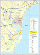
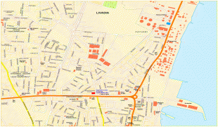
Map - Larnaca International Airport (Larnaca International Airport)
Map


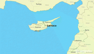

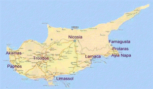
Country - Cyprus
 |
 |
| Flag of Cyprus | |
The earliest known human activity on the island dates to around the 10th millennium BC. Archaeological remains include the well-preserved ruins from the Hellenistic period such as Salamis and Kourion, and Cyprus is home to some of the oldest water wells in the world. Cyprus was settled by Mycenaean Greeks in two waves in the 2nd millennium BC. As a strategic location in the Eastern Mediterranean, it was subsequently occupied by several major powers, including the empires of the Assyrians, Egyptians and Persians, from whom the island was seized in 333 BC by Alexander the Great. Subsequent rule by Ptolemaic Egypt, the Classical and Eastern Roman Empire, Arab caliphates for a short period, the French Lusignan dynasty and the Venetians was followed by over three centuries of Ottoman rule between 1571 and 1878 (de jure until 1914).
Currency / Language
| ISO | Currency | Symbol | Significant figures |
|---|---|---|---|
| EUR | Euro | € | 2 |
| ISO | Language |
|---|---|
| EN | English language |
| EL | Greek language |
| TR | Turkish language |