Lajas (Lajas Municipio)
 |
Located at the Lajas Valley, the town was founded in 1883 by the Xueta Teodoro Jacome Pagan. Xuetes (Chuetas) were Majorcan Jews (Sephardi Catalan Jews). Some families changed their names from Jacome to the Castilian form Santiago. Jacome is the Mallorquin form of James (Ia'akov). Catalan Jews from Majorca were part of the early settlers in the South of (Boriken) (Puerto Rico).
Puerto Rico was ceded by Spain in the aftermath of the Spanish–American War under the terms of the Treaty of Paris of 1898 and became a territory of the United States. In 1899, the United States Department of War conducted a census of Puerto Rico finding that the population of Lajas was 8,789.
The village of La Parguera is a popular tourist destination to see the famous Bahía Fosforescente (Phosphorescent Bay) and its numerous keys and islets.
People from the El Combate community in barrio Boquerón are known as mata con hacha ("those who kill with axes") based on folklore about a fight over the salinas, where those from Cabo Rojo fought with axes against people from the adjacent town of Lajas. Because the people from Lajas apparently fought back by throwing stones they are known as tira piedras ("those who throw stones").
On September 20, 2017 Hurricane Maria struck Puerto Rico. In Lajas, over 270 residences lost their roof. The hurricane destroyed Lajas' pineapple industry.
Map - Lajas (Lajas Municipio)
Map


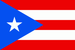
Country - Puerto Rico
 |
 |
Currency / Language
| ISO | Currency | Symbol | Significant figures |
|---|---|---|---|
| USD | United States dollar | $ | 2 |
| ISO | Language |
|---|---|
| EN | English language |
| ES | Spanish language |