Lae Atoll (Lae Atoll)
Lae Atoll (Marshallese: Lae, ) is a coral atoll of 20 islands in the Pacific Ocean, and forms a legislative district of the Ralik Chain of the Marshall Islands. Its total land area is only 1.5 km2, but it encloses a lagoon with an area of 17.7 km2. It is located approximately 47 km east of Ujae Atoll. The population of Lae Atoll was 347 in 2011. Its islands include Lae, Looj (Lotj), Bilalalon, Riblong (Ribon) and Lweijab (Lejab).
In early 1884, Japanese explorer and agent Suzuki Tsunenori was dispatched to Lae Atoll to investigate the murder of a Japanese sailor. When he arrived, he raised the national flag and claimed the island for Japan. However, he was ordered to return to the island to take down the flag, and the government made no formal gestures towards annexation of the islands. Lae Atoll was claimed by the Empire of Germany along with the rest of the Marshall Islands later that year, and the Germans established a trading outpost. After World War I, the island came under the South Seas Mandate of the Empire of Japan. Following the end of World War II, Lae came under the control of the United States as part of the Trust Territory of the Pacific Islands. It has been part of the independent Republic of the Marshall Islands since 1986.
In early 1884, Japanese explorer and agent Suzuki Tsunenori was dispatched to Lae Atoll to investigate the murder of a Japanese sailor. When he arrived, he raised the national flag and claimed the island for Japan. However, he was ordered to return to the island to take down the flag, and the government made no formal gestures towards annexation of the islands. Lae Atoll was claimed by the Empire of Germany along with the rest of the Marshall Islands later that year, and the Germans established a trading outpost. After World War I, the island came under the South Seas Mandate of the Empire of Japan. Following the end of World War II, Lae came under the control of the United States as part of the Trust Territory of the Pacific Islands. It has been part of the independent Republic of the Marshall Islands since 1986.
Map - Lae Atoll (Lae Atoll)
Map


Country - Marshall_Islands
 |
 |
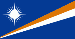
| Flag of the Marshall Islands | |
The country's population of 42,050 people (at the 2021 World Bank Census ) is spread out over five islands and 29 coral atolls, comprising 1,156 individual islands and islets. The capital and largest city is Majuro. It has the largest portion of its territory composed of water of any sovereign state, at 97.87%. The islands share maritime boundaries with Wake Island to the north, Kiribati to the southeast, Nauru to the south, and the Federated States of Micronesia to the west. About 52.3% of Marshall Islanders (27,797 at the 2011 Census) live on Majuro. In 2016, 73.3% of the population were defined as being "urban". The UN also indicates a population density of 295 PD/km2, and its projected 2020 population is 59,190.
Currency / Language
| ISO | Currency | Symbol | Significant figures |
|---|---|---|---|
| USD | United States dollar | $ | 2 |
| ISO | Language |
|---|---|
| EN | English language |
| MH | Marshallese language |