Labuan
 |
 |
For three centuries from the 15th century, the north and west coast of Borneo including the island of Labuan was part of the Sultanate of Brunei. In 1775, Labuan was temporarily occupied by the British East India Company after the failure of the company's station at Balambangan Island. The Sultan of Brunei, Omar Ali Saifuddin I tried to secure the British East India Company’s support against the Sulu raiders by offering Labuan as an alternative to Balambangan but, instead the company made a second but failed attempt to set up a station on Balambangan. The Sultan's subsequent reoffering of Labuan to the company did not result in the establishment of a permanent British settlement on the island either.
British policy changed in the 18th century, when Labuan started to attract British interest again. James Brooke acquired the island for Britain through the Treaty of Labuan with the Sultan of Brunei, Omar Ali Saifuddin II on 18 December 1846. A British naval officer, Rodney Mundy, visited Brunei with his ship HMS Iris to keep the Sultan in line until the British Government made a final decision to take the island and he took Pengiran Mumin to witness the island's accession to the British Crown on 24 December 1846. Some sources state that during the signing of the treaty, the Sultan had been threatened by a British navy warship ready to fire on the Sultan's palace if he refused to sign the treaty while another source says the island was ceded to Britain as a reward for assistance in combating pirates.
The main reason why the British acquired the island was to establish a naval station to protect their commercial interest in the region and to suppress piracy in the South China Sea. The British also believed the island could be the next Singapore. The island became a Crown Colony in 1848 with James Brooke appointed as the first governor and commander-in-chief, with William Napier as his lieutenant-governor. In 1849, the Eastern Archipelago Company became the first of several British companies to try to exploit Labuan coal deposits. The company was formed to exploit coal deposits on the island and adjacent coast of Borneo but soon became involved in a dispute with James Brooke. Not proving itself a great commercial or strategic asset, administration of Labuan was handed to the British North Borneo Company in 1890. In 1894, a submarine communications cable was built by the British to link the island's communications with North Borneo, Singapore and Hong Kong for the first time. By 30 October 1906, the British Government proposed to extend the boundaries of the Straits Settlements to include Labuan. The proposal took effect from 1 January 1907.
In World War II, Labuan was occupied by Japan from 3 January 1942 until June 1945 and garrisoned by units of the Japanese 37th Army, which controlled Northern Borneo. The island served as the administrative centre for the Japanese forces. During the occupation, the Japanese Government changed the island name to Maida Island (前田島 [Maeda-shima]) on 9 December 1942 after Marquis Toshinari Maeda, as a remembrance to the first Japanese commander in northern Borneo. Maeda was killed in an air crash at Bintulu, Sarawak when en route to the island to open the airfield there. As the Allied counter-attack came closer, the Japanese also developed Labuan and Brunei Bay as a naval base.
The liberation of Borneo by the Allied forces began on 10 June 1945 when the Australian Army under the command of Australian Major General George Wootten launched an attack under the codename of Operation Oboe Six. Labuan became the main objective for the Allied forces to repossess. Soon, the 9th Division of the Australian Army launched the attack with support from airstrikes and sea bombardments until the capture of the Labuan airstrip. Most of the Labuan island area including the main town of Victoria was under the control of Allied forces within four days of the landing on 10 June. On 9 September 1945, the Japanese Lieutenant General Masao Baba officially surrendered at a place now known as Surrender Point near the Layang-layang beach which he had been brought to the 9th Division headquarters on the island to sign the surrender document in front of the Australian 9th Division Army Commander George Wootten.
The name of Labuan was later restored by the British and the island was administered under the British Military Administration together with the rest of the Straits Settlements. Labuan then on 15 July 1946 joined the North Borneo Crown Colony, which in turn became a part of the state of Sabah and Malaysia in 1963. In 1984, the Government of Sabah ceded Labuan to the federal government and later was admitted as a federal territory. It was declared an international offshore financial centre and free trade zone in 1990.
Map - Labuan
Map


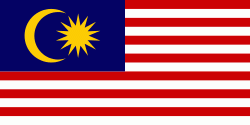
Country - Malaysia
 |
 |
| Flag of Malaysia | |
Malaysia has its origins in the Malay kingdoms, which, from the 18th century on, became subject to the British Empire, along with the British Straits Settlements protectorate. Peninsular Malaysia was unified as the Malayan Union in 1946. Malaya was restructured as the Federation of Malaya in 1948 and achieved independence on 31 August 1957. The independent Malaya united with the then British crown colonies of North Borneo, Sarawak, and Singapore on 16 September 1963 to become Malaysia. In August 1965, Singapore was expelled from the federation and became a separate independent country.
Currency / Language
| ISO | Currency | Symbol | Significant figures |
|---|---|---|---|
| MYR | Malaysian ringgit | RM | 2 |
| ISO | Language |
|---|---|
| ZH | Chinese language |
| EN | English language |
| MS | Malay language |
| ML | Malayalam language |
| PA | Panjabi language |
| TA | Tamil language |
| TE | Telugu language |
| TH | Thai language |