Kurram District (Kurram District)
Kurram District (کرم ولسوالۍ, ) is a district in Kohat Division of Khyber Pakhtunkhwa province in Pakistan.The name Kurram comes from the river Kuramá (کورمه) in Pashto which itself derives from the Sanskrit name Krumuḥ (क्रुमुः).
Until 2018, it was an agency of Federally Administered Tribal Areas, with merger of FATA with Khyber Pakhtunkhwa, it became a district. Geographically, it covers the Kurram Valley region which is a valley in the northwestern part of Pakistan. Most of the population is Pashtun and the main religion is Islam (Shia and Sunni). Major tribes living in Kurram Agency are Bangash, Turi, Orakzai, as well as Mamozai, Muqbil, Zazai, Paracha, Mangal, Ghilzai, Para Chamkani, Hazara and Khoshi tribe (Persian speaking tribe).
Until the year 2000, when the old divisions were abolished, the Kurram District used to be part of the Peshawar Division of the North-West Frontier Province of Pakistan.
The name Kurram comes from the river Kurram, which flows along the valley. In the north it is surrounded by snow-covered or "white" mountains, the Safed Koh, locally known in Pashto as Spīn Ghar, which also forms the natural border with Afghanistan. Kurram Agency is just like a beak of a bird and is connected with three provinces of Afghanistan named as Khost, Paktia and Nangarhar (Tora bora).
Kurram Agency is located in the FATA and its major tribes are Bangash, Turi, Orakzai, Para-Chamkani, Mangal, Alisherzai, Muqbil, Khuaidadkhel and Masozai.
In Lower Kurram Agency, Sadda is a scenic place where tribes such as the Bangash reside and Sadda has natural richness depended upon hills and mountain with evergreen forests and fields for growing crops like rice and wheat.
The Kurram River drains the southern flanks of the Safed Koh mountain range, and enters the Indus plains north of Bannu. It flows west to east and crosses the Paktia Province Afghan-Pakistan border at about 80 km southwest of Jalalabad, and joins the Indus near Isa Khel after a course of more than 320 km. The district has an area of 3,310 km2; the population according to the 1998 census was 448,310. It lies between the Miranzai Valley. It is inhabited by the Bangash and Mangal tribes.
Map - Kurram District (Kurram District)
Map
Country - Pakistan
 |
 |
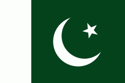
| Flag of Pakistan | |
Pakistan is the site of several ancient cultures, including the 8,500-year-old Neolithic site of Mehrgarh in Balochistan, the Indus Valley civilisation of the Bronze Age, the most extensive of the civilisations of the Afro-Eurasia, and the ancient Gandhara civilization. The region that comprises the modern state of Pakistan was the realm of multiple empires and dynasties, including the Achaemenid; briefly that of Alexander the Great; the Seleucid, the Maurya, the Kushan, the Gupta; the Umayyad Caliphate in its southern regions, the Hindu Shahis, the Ghaznavids, the Delhi Sultanate, the Mughals, the Durranis, the Omani Empire, the Sikh Empire, British East India Company rule, and most recently, the British Indian Empire from 1858 to 1947.
Currency / Language
| ISO | Currency | Symbol | Significant figures |
|---|---|---|---|
| PKR | Pakistani rupee | ₨ | 2 |
| ISO | Language |
|---|---|
| EN | English language |
| PA | Panjabi language |
| PS | Pashto language |
| SD | Sindhi language |
| UR | Urdu |


