Kumlinge
 |
The municipality has a population of 0 and covers an area of undefined km2 of which undefined km2 is water. The population density is undefined PD/km2.
0 of the population is Swedish-speaking, 0 is Finnish-speaking, and 0 speak other languages.
The Kumlinge Airfield is situated on the main island.
The first visitors to Kumlinge were Vikings who stopped there during their voyages. The first permanent residents arrived in the 13th century. According to taxrolls from the 16th century there were about a dozen houses on the main island at the time, home to mostly farmers and fishermen. In the 20th century the population of Kumlinge slowly began to decline.
Map - Kumlinge
Map


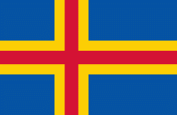
Country - Åland_Islands
 |
 |
Åland is situated in an archipelago, called the Åland Islands, at the entrance to the Gulf of Bothnia in the Baltic Sea belonging to Finland. It comprises Fasta Åland on which 90% of the population resides and about 6,500 skerries and islands to its east. Of Åland's thousands of islands, about 60–80 are inhabited. Fasta Åland is separated from the coast of Roslagen in Sweden by 38 km of open water to the west. In the east, the Åland archipelago is contiguous with the Finnish archipelago. Åland's only land border is located on the uninhabited skerry of Märket, which it shares with Sweden. From Mariehamn, there is a ferry distance of about 160 km to Turku, a coastal city of mainland Finland, and also to Stockholm, the capital of Sweden.
Currency / Language
| ISO | Currency | Symbol | Significant figures |
|---|---|---|---|
| EUR | Euro | € | 2 |
| ISO | Language |
|---|---|
| SV | Swedish language |
