Kültəpə
Kültəpə (also rendered as Aşağı Gültəpə, Gültəpə, Kyul'tepe, Kul'tepe, and Kultepe) is a settlement dating from the Neolithic Age, a village and municipality in the Babek District of Nakhchivan, Azerbaijan. It has a population of 1,859.
In 1951, archeologist Osman Habibulla began excavation in the settlement, clarifying the stratigraphy and cultural strata of the area. The tell was much disturbed in the past.
As excavators had found, the town features a cultural layer with the total depth of 22 m. The earliest 9 m of this belongs to the Neolithic Age. Some Halaf culture artifacts have been found.
On top of that are the remains of the Bronze Age, and then the Early Iron Age.
At each of these layers a variety of artifacts were found: pottery dishes, cattle-breeding and agricultural implements, adornments, weapons etc.
In the Eneolithic layer the excavators discovered remains of buildings, as well as burial places. These buildings were round as well as rectangular-shaped, and were made of mudbrick. The diameter of the round constructions was around 6–8 meters. The rectangular ones are about 15 sq. m in size. These structures were typically connected with agriculture.
85 burial places were investigated in the Eneolithic layer. In 31 of those excavators found pottery dishes, items made of bones and stone, and beads.
Map - Kültəpə
Map
Country - Azerbaijan
 |
 |
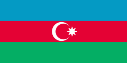
| Flag of Azerbaijan | |
The Azerbaijan Democratic Republic proclaimed its independence from the Transcaucasian Democratic Federative Republic in 1918 and became the first secular democratic Muslim-majority state. In 1920, the country was incorporated into the Soviet Union as the Azerbaijan SSR. The modern Republic of Azerbaijan proclaimed its independence on 30 August 1991, shortly before the dissolution of the Soviet Union in the same year. In September 1991, the ethnic Armenian majority of the Nagorno-Karabakh region formed the self-proclaimed Republic of Artsakh. The region and seven surrounding districts are internationally recognized as part of Azerbaijan pending a solution to the status of the Nagorno-Karabakh through negotiations facilitated by the OSCE, although became de facto independent with the end of the First Nagorno-Karabakh War in 1994. Following the Second Nagorno-Karabakh War in 2020, the seven districts and parts of Nagorno-Karabakh were returned to Azerbaijani control.
Currency / Language
| ISO | Currency | Symbol | Significant figures |
|---|---|---|---|
| AZN | Azerbaijani manat | ₼ | 2 |
| ISO | Language |
|---|---|
| HY | Armenian language |
| AZ | Azerbaijani language |
| RU | Russian language |


