Map - Košice Region (Kosice)

Košice Region (Kosice)
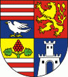
The Košice Region (Košický kraj,, Kassai kerület; Кошицький край) is one of the eight Slovak administrative regions. The region was first established in 1923 and its present borders were established in 1996. It consists of 11 districts (okresy) and 440 municipalities, 17 of which have a town status. About one third of the region's population lives in the agglomeration of Košice, which is its main economic and cultural centre.

It is located in the southern part of eastern Slovakia and covers an area of 6,752 km2. The western part of the region is composed of the eastern part of the Slovak Ore Mountains, including its subdivisions: Slovak Karst, Slovak Paradise, Volovské vrchy, Čierna hora. The Hornád Basin is located in the northwest. The area between Slovak Ore Mountains and Slanské vrchy is covered by the Košice Basin, named after the city. The area east of Slanské vrchy is covered by the Eastern Slovak Lowland and there is a volcanic range, Vihorlat Mountains, in the northeast, close to the Ukrainian border. Bigger rivers include Slaná in the southwest, Hornád in the west and centre, Uh and Bodrog in the east, along with a small part of the Tisza river in the extreme southeast. As for administrative divisions, the region borders Prešov Region in the north, Zakarpattia Oblast of Ukraine in the east, Szabolcs-Szatmár-Bereg and Borsod-Abaúj-Zemplén counties of Hungary in the south and the Banská Bystrica Region in the west.

 
Map - Košice Region (Kosice)
Map
Google Earth - Map - Košice Region
Google Earth
Openstreetmap - Map - Košice Region
Openstreetmap
Map - Košice Region - Esri.WorldImagery
Esri.WorldImagery
Map - Košice Region - Esri.WorldStreetMap
Esri.WorldStreetMap
Map - Košice Region - OpenStreetMap.Mapnik
OpenStreetMap.Mapnik
Map - Košice Region - OpenStreetMap.HOT
OpenStreetMap.HOT
Map - Košice Region - OpenTopoMap
OpenTopoMap
Map - Košice Region - CartoDB.Positron
CartoDB.Positron
Map - Košice Region - CartoDB.Voyager
CartoDB.Voyager
Map - Košice Region - OpenMapSurfer.Roads
OpenMapSurfer.Roads
Map - Košice Region - Esri.WorldTopoMap
Esri.WorldTopoMap
Map - Košice Region - Stamen.TonerLite
Stamen.TonerLite
Country - Slovakia
Flag of Slovakia
Slovakia ( Slovensko ), officially the Slovak Republic (Slovenská republika ), is a landlocked country in Central Europe. It is bordered by Poland to the north, Ukraine to the east, Hungary to the south, Austria to the southwest, and the Czech Republic to the northwest. Slovakia's mostly mountainous territory spans about 49000 km2, with a population of over 5.4 million. The capital and largest city is Bratislava, while the second largest city is Košice.

The Slavs arrived in the territory of present-day Slovakia in the fifth and sixth centuries. In the seventh century, they played a significant role in the creation of Samo's Empire. In the ninth century, they established the Principality of Nitra, which was later conquered by the Principality of Moravia to establish Great Moravia. In the 10th century, after the dissolution of Great Moravia, the territory was integrated into the Principality of Hungary, which then became the Kingdom of Hungary in 1000. In 1241 and 1242, after the Mongol invasion of Europe, much of the territory was destroyed. The area was recovered largely thanks to Béla IV of Hungary, who also settled Germans, leading them to become an important ethnic group in the area, especially in what are today parts of central and eastern Slovakia.
Currency / Language  
ISO Currency Symbol Significant figures
EUR Euro € 2
Neighbourhood - Country  
  •  Austria 
  •  Czech Republic 
  •  Hungary 
  •  Poland 
  •  Ukraine