Kotayk Province (Kotayk’i Marz)
Kotayk is bordered by Lori Province from the north, Tavush Province from the northeast, Gegharkunik Province from the east, Aragatsotn Province from the west, and Ararat Province and the capital Yerevan from the south. Kotayk is the only province in Armenia that has no borders with foreign countries.
The province is home to many ancient landmarks and tourist attractions in Armenia including the 1st-century Temple of Garni, the medieval Bjni Fortress, 11th-century Kecharis Monastery and the 13th-century monastery of Geghard. Kotayk is also home to the popular winter sports resort and the spa-town of Tsaghkadzor and the mountain resort of Aghveran.
Kotayk Province is named after the historic Kotayk canton of the historic Ayrarat province of Ancient Armenia, directly ruled by the royal Arsacid dynasty.
Kotayk was first mentioned as an Armenian region by Ptolemy as Kotakene. According to Movses Khorenatsi, the name Kotayk is derived from an ancient nearby settlement called Kutis.
The symbol of Kotayk is the lion of Geghard depicted on the coat of arms of the province, standing on a traditional Armenian sundial from Kecharis Monastery, surround by a bunch of Armenian grapes from both sides. The decorative statue of the lion of Geghard was erected in 1958 among the mountains of Kotayk, on the way to the 4th-century Geghard monastery. It is derived from the decorative lions carved on the walls of the monastery. The 1st-century pagan Temple of Garni is also depicted on the coat of arms of Kotayk.
Map - Kotayk Province (Kotayk’i Marz)
Map


Country - Armenia
 |
 |
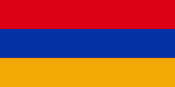
| Flag of Armenia | |
Armenia is a unitary, multi-party, democratic nation-state with an ancient cultural heritage. The first Armenian state of Urartu was established in 860 BC, and by the 6th century BC it was replaced by the Satrapy of Armenia. The Kingdom of Armenia reached its height under Tigranes the Great in the 1st century BC and in the year 301 became the first state in the world to adopt Christianity as its official religion. The ancient Armenian kingdom was split between the Byzantine and Sasanian Empires around the early 5th century. Under the Bagratuni dynasty, the Bagratid Kingdom of Armenia was restored in the 9th century. Declining due to the wars against the Byzantines, the kingdom fell in 1045 and Armenia was soon after invaded by the Seljuk Turks. An Armenian principality and later a kingdom Cilician Armenia was located on the coast of the Mediterranean Sea between the 11th and 14th centuries.
Currency / Language
| ISO | Currency | Symbol | Significant figures |
|---|---|---|---|
| AMD | Armenian dram | Ö | 2 |
| ISO | Language |
|---|---|
| HY | Armenian language |