Kota Kinabalu International Airport (Kota Kinabalu International Airport)
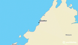
Kota Kinabalu International Airport (KKIA) is an international airport in Kota Kinabalu, the state capital of Sabah, Malaysia. It is located approximately 8 km southwest of the city centre. In 2017, 8 million passengers passed through the airport, making it the second busiest airport in Malaysia after Kuala Lumpur International Airport and the busiest airport in Borneo island. A medium-sized airport with good connections to most major aviation hubs across the Asia-Pacific region, the airport serves the city of Kota Kinabalu as well as the entire west coast of Sabah.
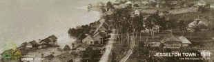
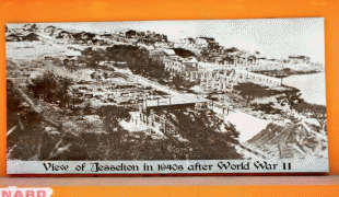
The airport began as a military airfield built by the Imperial Japanese Army during World War II. It was then known as Jesselton Airfield (Kota Kinabalu was known as Jesselton at the time). Towards the end of the war, it suffered severe bombings by Allied Forces. After the war, the Department of Civil Aviation (DCA) of North Borneo (now Sabah) took over the operation and maintenance of the airport.
Regular passenger service commenced in May 1949, with a weekly Malayan Airways flight from Singapore, via Kuching and Labuan; the route was extended to Sandakan in September 1949. By 1950, the airport served as a stopover for a biweekly flights between Hong Kong and Labuan, via Manila and Sandakan operated by Cathay Pacific. The domestic air service was further developed by Sabah Airways Limited (later known as Borneo Airways) in 1953, connecting the town to Sandakan, Kudat, Ranau, Keningau and Tawau.
By 1957, the original grass strip runway was resurfaced with bitumen material and a new terminal was built. In 1959, the runway had been extended to 1,593 metres to enable the operation of Malayan Airways' turboprop Viscount aircraft.
By 1963, the runway was further reinforced and lengthened to 1,921 meters to cater for Malaysian Airways Comet 4 jet operations. Commercial flights and passenger arrivals gradually increased and a larger terminal building was needed. By 1967, Cathay Pacific Airways operated a twice-weekly Convair 880 jet service between the airport and Hong Kong with an intermediate stop in Manila.
In 1969, a British consultancy firm was appointed to formulate a Master Plan for a phased and organised development of KKIA over the next few decades. The master plan was submitted to the government with recommendations to:
* reinforce and extend the runway to 2,987 metres to cater for Boeing 707 and 747 jet operations
* build a new terminal complex and parallel taxiway connecting to the runway
* provide navigation equipment, communication facilities and a modern light system for the runway
In the 1970s and 1980s, a new terminal building was built on the other side of the runway from the original terminal. Almost all commercial flights were shifted to this newer and larger terminal. Subsequently, the original terminal became known as the Airport Lama ("Old Airport"). In 1992, the DCA of Sabah was corporatised and Malaysia Airports Holdings Berhad took over the management and operations of the airport. A further expansion project for both terminals began in 2006, and in January 2007 the original terminal was rebranded Terminal 2 whilst the newer terminal became known as Terminal 1.
| IATA Code | BKI | ICAO Code | WBKK | FAA Code | |
|---|---|---|---|---|---|
| Telephone | Fax | ||||
| Home page |
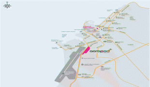
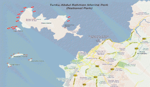
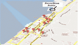
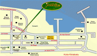
Map - Kota Kinabalu International Airport (Kota Kinabalu International Airport)
Map


Country - Malaysia
 |
 |
| Flag of Malaysia | |
Malaysia has its origins in the Malay kingdoms, which, from the 18th century on, became subject to the British Empire, along with the British Straits Settlements protectorate. Peninsular Malaysia was unified as the Malayan Union in 1946. Malaya was restructured as the Federation of Malaya in 1948 and achieved independence on 31 August 1957. The independent Malaya united with the then British crown colonies of North Borneo, Sarawak, and Singapore on 16 September 1963 to become Malaysia. In August 1965, Singapore was expelled from the federation and became a separate independent country.
Currency / Language
| ISO | Currency | Symbol | Significant figures |
|---|---|---|---|
| MYR | Malaysian ringgit | RM | 2 |
| ISO | Language |
|---|---|
| ZH | Chinese language |
| EN | English language |
| MS | Malay language |
| ML | Malayalam language |
| PA | Panjabi language |
| TA | Tamil language |
| TE | Telugu language |
| TH | Thai language |