Map - Kingstown Park

Kingstown Park
 
Map - Kingstown Park
Map
Google Earth - Map - Kingstown Park
Google Earth
Openstreetmap - Map - Kingstown Park
Openstreetmap
Map - Kingstown Park - Esri.WorldImagery
Esri.WorldImagery
Map - Kingstown Park - Esri.WorldStreetMap
Esri.WorldStreetMap
Map - Kingstown Park - OpenStreetMap.Mapnik
OpenStreetMap.Mapnik
Map - Kingstown Park - OpenStreetMap.HOT
OpenStreetMap.HOT
Map - Kingstown Park - OpenTopoMap
OpenTopoMap
Map - Kingstown Park - CartoDB.Positron
CartoDB.Positron
Map - Kingstown Park - CartoDB.Voyager
CartoDB.Voyager
Map - Kingstown Park - OpenMapSurfer.Roads
OpenMapSurfer.Roads
Map - Kingstown Park - Esri.WorldTopoMap
Esri.WorldTopoMap
Map - Kingstown Park - Stamen.TonerLite
Stamen.TonerLite
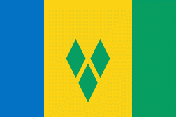
Country - Saint_Vincent_and_the_Grenadines
Saint Vincent and the Grenadines is an island country in the Caribbean. It is located in the southeast Windward Islands of the Lesser Antilles, which lie in the West Indies, at the southern end of the eastern border of the Caribbean Sea, where the latter meets the Atlantic Ocean.

Its 369 km2 territory consists of the main island of Saint Vincent and, south of that, two-thirds of the northern part of the Grenadines, a chain of 32 smaller islands. Some of the Grenadines are inhabited—Bequia, Mustique, Union Island, Canouan, Petit Saint Vincent, Palm Island, Mayreau, Young Island—while others are not: Tobago Cays, Baliceaux, Battowia, Quatre, Petite Mustique, Savan and Petit Nevis. Most of Saint Vincent and the Grenadines lies within the Hurricane Alley.
Currency / Language  
ISO Currency Symbol Significant figures
XCD East Caribbean dollar $ 2
Neighbourhood - Country  
Language