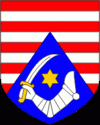
Karlovac County (Karlovac)
 |
The city of Karlovac is a fort from the times of the Military Frontier. It was built as a six-side star fort in the 16th century at the point of confluence of four rivers. The town blossomed in the 18th and 19th century after being made a free town, with the development of roads between Pannonian Basin to the Adriatic Sea, and waterways along the Kupa river. The city is making use of its crucial geostrategic point in Croatia.
The county itself extends towards the north to the water springs of Jamnica, and towards the south all the way down to the mountainous regions of Gorski Kotar and Lika, in particular to the Bjelolasica mountain which features the largest winter sport recreation center in the country.
Karlovac County is divided:
* City of Karlovac (county seat)
* City of Ogulin
* Town of Duga Resa
* Town of Ozalj
* Town of Slunj
* Municipality of Barilović
Map - Karlovac County (Karlovac)
Map
Country - Croatia
Currency / Language
| ISO | Currency | Symbol | Significant figures |
|---|---|---|---|
| HRK | Croatian kuna | kn | 2 |
| ISO | Language |
|---|---|
| HR | Croatian language |
| SR | Serbian language |


