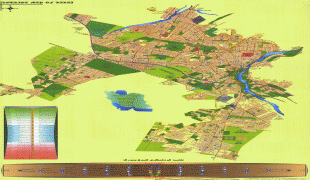
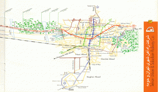
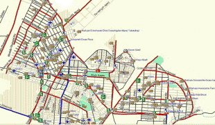
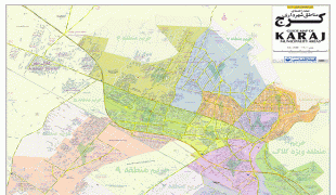
Karaj
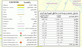
Karaj is the capital of Alborz Province, Iran, and effectively a satellite city of Tehran. Although the county hosts a population around 1.97 million, as recorded in the 2016 census, most of the 1,419 km2 county is rugged mountain. The urban area is the fourth-largest in Iran, after Tehran, Mashhad, and Isfahan. Eshtehard County and Fardis County were split off from Karaj County since the previous census.
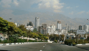
The earliest records of Karaj date back to the 30th century BC. The city was developed under the rule of the Safavid and Qajar dynasties and is home to historical buildings and memorials from those eras. This city has a unique climate due to access to natural resources such as many trees, rivers, and green plains. After Tehran, Karaj is the largest immigrant-friendly city in Iran, so it has been nicknamed "Little Iran."
The area around Karaj has been inhabited for thousands of years, such as at the Bronze Age site of Tepe Khurvin and the Iron Age site of Kalak. However, the present-day city of Karaj is mostly the result of modern industrial development in the 20th century.
Historically, Karaj was mostly significant as a stage on the road between Tehran and Qazvin. In Safavid times, a stone bridge was built that served as the main crossing into the town. The large Shah-Abbasi Caravansary, located at the southeast of Towhid Square, was built in the same era, under the rule of Šāh Esmāil.
In 1810, the Qajar prince Soleyman Mirza built the Soleymaniyeh Palace at Kajar to serve as a summer resort. The palace had four towers and was surrounded by gardens, and its reception room featured a pair of paintings by Abdallah Khan Naqqashbandi. By 1860, however, the palace was described as abandoned and only used as a shelter for travelers. Naser al-Din Shah Qajar later renovated the palace. In 1917, a School of Farming was established on the site, replacing the earlier Mozaffari Agricultural School in Tehran. Later, Reza Shah Pahlavi granted it to the University of Tehran's new Faculty of Agriculture.
In the 1930s, plans were drawn up for a large industrial complex covering 216 hectares on the south side of the village. This "Industrial Model Town of Karaj" was intended to be the site of the country's first steel mills, capitalizing on easy access to water and coal from the Alborz. However, the construction equipment imported from Germany was seized by the British at the Suez Canal, and the planned complex was never built.
A major industrial complex, the first privately-owned one in Karaj, was built in the 1960s by Mohammad-Sadeq Fateh. This complex, called Shahrak-e Jahanshahr, included oil, tea, and textile factories as well as housing for the workers.
The Morvārid Palace was constructed in nearby Mehršahr district, during the Pahlavi era. It was designed by the Frank Lloyd Wright Foundation (Taliesin Associated Architects) on instructions from Shams Pahlavi, elder sister of Mohammad Reza Pahlavi. In this period it was a transit and industrial town.
Majority of the structure is now controlled by the Basij Organization, and some sections of it are open to public under the operation of Cultural Heritage Organization of Iran.
Other historical sites of the city include the Mausoleum of Šāhzāde Soleymān, Emāmzāde Rahmān, Emāmzāde Zeyd, and Palang Ābād e Eštehārd.
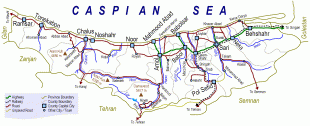
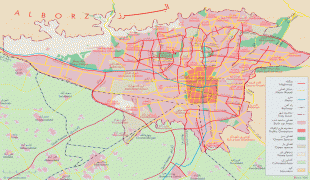
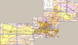
Map - Karaj
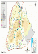
Map


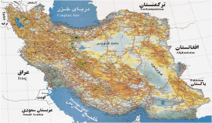
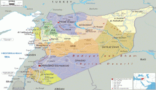
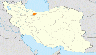
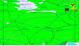
Country - Iran
 |
 |
| Flag of Iran | |
The country is home to one of the world's oldest civilizations, beginning with the formation of the Elamite kingdoms in the fourth millennium BC. It was first unified by the Medes, an ancient Iranian people, in the seventh century BC, and reached its territorial height in the sixth century BC, when Cyrus the Great founded the Achaemenid Persian Empire, which became one of the largest empires in history and a superpower. The Achaemenid Empire fell to Alexander the Great in the fourth century BC and was subsequently divided into several Hellenistic states. An Iranian rebellion established the Parthian Empire in the third century BC, which was succeeded in the third century AD by the Sassanid Empire, a major world power for the next four centuries. Arab Muslims conquered the empire in the seventh century AD, which led to the Islamization of Iran. It subsequently became a major center of Islamic culture and learning, with its art, literature, philosophy, and architecture spreading across the Muslim world and beyond during the Islamic Golden Age. Over the next two centuries, a series of native Iranian Muslim dynasties emerged before the Seljuk Turks and the Mongols conquered the region. In the 15th century, the native Safavids re-established a unified Iranian state and national identity, and converted the country to Shia Islam. Under the reign of Nader Shah in the 18th century, Iran presided over the most powerful military in the world, though by the 19th century, a series of conflicts with the Russian Empire led to significant territorial losses. The early 20th century saw the Persian Constitutional Revolution. Efforts to nationalize its fossil fuel supply from Western companies led to an Anglo-American coup in 1953, which resulted in greater autocratic rule under Mohammad Reza Pahlavi and growing Western political influence. He went on to launch a far-reaching series of reforms in 1963. After the Iranian Revolution, the current Islamic Republic was established in 1979 by Ruhollah Khomeini, who became the country's first Supreme Leader.
Currency / Language
| ISO | Currency | Symbol | Significant figures |
|---|---|---|---|
| IRR | Iranian rial | ï·¼ | 2 |
| ISO | Language |
|---|---|
| KU | Kurdish language |
| FA | Persian language |