Kampong Thom Province (Kampong Thom)
The provincial capital is Stung Saen, a town of approximately 30,000 people on the banks of the Stung Sen River.
Kampong Thom is Cambodia's second largest province by area. There are a number of significant Angkorian sites in the area, including Prasat Sambor Prei Kuk and Prasat Andet temples. As one of the nine provinces bordering Tonle Sap Lake, Kampong Thom is part of the Tonlé Sap Biosphere Reserve.
Kampong Thom in Khmer means 'great port' or 'great harbor'. Kampong in Khmer translates as 'port' or 'harbor'. The word Kampong is shared in other Asian languages, the Malay and Indonesian, both meaning 'village'. Thom in the Khmer language means 'big', 'grand', or 'large'.
Map - Kampong Thom Province (Kampong Thom)
Map


Country - Khmer_Republic
 |
 |
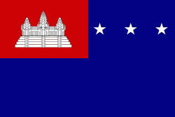
| Flag of Cambodia | |
The main cause of the coup was Norodom Sihanouk's tolerance of North Vietnamese military activity within Cambodia's borders; Vietnamese communist forces had gained de facto control over vast areas of eastern Cambodia as a result. Another important factor was the dire state of the Cambodian economy, an indirect result of Sihanouk's policies of pursuing neutrality.
Currency / Language
| ISO | Currency | Symbol | Significant figures |
|---|---|---|---|
| KHR | Cambodian riel | ៛ | 2 |
| ISO | Language |
|---|---|
| KM | Central Khmer language |
| EN | English language |
| FR | French language |