Jurong (Jurong Town)
Jurong is a major geographical region located at the south-westernmost point of the West Region of Singapore. Although mostly vaguely defined, the region's extent roughly covers the planning areas of Jurong East, Jurong West, Boon Lay, and Pioneer, along with Jurong Island in the Western Islands cluster and the southernmost portions of the Western Water Catchment. Should it be described at its greatest historical extent, the region can also include present-day Bukit Batok and Tuas.
Jurong also covers several offshore islands as well, including Pulau Damar Laut and Pulau Samulun, both of which are located within the planning areas of Jurong East and Boon Lay respectively; along with the aforementioned Jurong Island. The coastline of the region on mainland Singapore, faces the strait of Selat Jurong, while the southernmost island of the region, Jurong Island, faces the strait of Selat Pandan.
Jurong was first developed and heavily industrialised in the late 1960s in response to the general economic situation of post-independence Singapore, and remains vital to the country's economic growth, either commercial, industrial and residential. The heavy redevelopment of the region paved the way for the opening of a large-scale industrial sector in the country, something which was unprecedented at that time. Today, Jurong has become one of the most densely-populated industrial areas in the country. Since the turn of the century, Jurong is envisioned to be the country's second central business district (CBD) as part of the Jurong Lake District project.
"Jurong" took its name from Sungei Jurong, a river that still channels into Jurong Lake, the latter of which was created by damming the river itself.
Although its origins are disputed, the core definition of "Jurong", is probably derived from several meanings in Malay. The term could probably refer to the word for shark, "Jerung". It can also be derived from the word "Jurang" or a gorge. Jurong could also take its name from the word, "Penjuru", which roughly translates to, corner. Penjuru may most likely refer to the peninsula that sits between Sungei Jurong and Sungei Pandan. The native Malays named this peninsula, Tanjong Penjuru, which can be translated as Cape Corner in English. The present-day site of Tanjong Penjuru is now the subzone of Penjuru Crescent.
Map - Jurong (Jurong Town)
Map
Country - Singapore
 |
 |
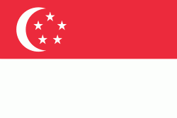
| Flag of Singapore | |
Singapore's history dates back at least a millennium, having been a maritime emporium known as Temasek and subsequently as a major constituent part of several successive thalassocratic empires. Its contemporary era began in 1819 when Stamford Raffles established Singapore as an entrepôt trading post of the British Empire. In 1867, the colonies in Southeast Asia were reorganised and Singapore came under the direct control of Britain as part of the Straits Settlements. During World War II, Singapore was occupied by Japan in 1942, and returned to British control as a separate Crown colony following Japan's surrender in 1945. Singapore gained self-governance in 1959 and in 1963 became part of the new federation of Malaysia, alongside Malaya, North Borneo, and Sarawak. Ideological differences, most notably the perceived encroachment of the egalitarian "Malaysian Malaysia" political ideology led by Lee Kuan Yew into the other constituent entities of Malaysia—at the perceived expense of the bumiputera and the policies of Ketuanan Melayu—eventually led to Singapore's expulsion from the federation two years later; Singapore became an independent sovereign country in 1965.
Currency / Language
| ISO | Currency | Symbol | Significant figures |
|---|---|---|---|
| SGD | Singapore dollar | $ | 2 |
| ISO | Language |
|---|---|
| ZH | Chinese language |
| EN | English language |
| MS | Malay language |
| TA | Tamil language |


