Jomala
 |
The municipality has a population of 0 and covers an area of undefined km2 of which undefined km2 is water. The population density is undefined PD/km2.
The municipality is unilingually Swedish.
Mariehamn Airport is located in Jomala. Three of Åland's four highways cross the municipality of Jomala as they start from Mariehamn; highway 1 runs west to Eckerö, highway 2 northeast to Sund and highway 3 east to Lumparland.
"Jomala" is the name of a god common to many Finnic peoples. Jumala is Finnish for god and Jomala is one of the sites where the Christian church organized itself in Finland. Other versions of the name that have occurred are Jwmala in 1356, Jomalum in 1414, Jomala in 1486 and Jwmala in 1494. One of oldest churches in Finland stands here as testament to these times.
Jomala was inhabited around 2000 BC with Jettböle being one of the most renowned prehistoric sites. Other ancient sites include Borgberget, where there was a Viking fortress, and Kasberget which was one of the many mountains where signal fires were lit when enemies were seen approaching.
Before the city of Mariehamn was established in 1861, the peninsula where the city is situated was a part of Jomala.
Map - Jomala
Map


Country - Åland_Islands
 |
 |
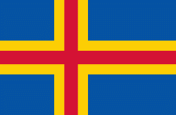
Åland is situated in an archipelago, called the Åland Islands, at the entrance to the Gulf of Bothnia in the Baltic Sea belonging to Finland. It comprises Fasta Åland on which 90% of the population resides and about 6,500 skerries and islands to its east. Of Åland's thousands of islands, about 60–80 are inhabited. Fasta Åland is separated from the coast of Roslagen in Sweden by 38 km of open water to the west. In the east, the Åland archipelago is contiguous with the Finnish archipelago. Åland's only land border is located on the uninhabited skerry of Märket, which it shares with Sweden. From Mariehamn, there is a ferry distance of about 160 km to Turku, a coastal city of mainland Finland, and also to Stockholm, the capital of Sweden.
Currency / Language
| ISO | Currency | Symbol | Significant figures |
|---|---|---|---|
| EUR | Euro | € | 2 |
| ISO | Language |
|---|---|
| SV | Swedish language |
