Map - Jinja District (Jinja District)

Jinja District (Jinja District)
Jinja District is a district in the Eastern Region of Uganda. The town of Jinja is the district's main municipal and commercial center.

Jinja District is bordered by Kamuli District to the north, Luuka District to the east, Mayuge District to the south-east, Buvuma District to the south, Buikwe District to the west, and Kayunga District to the north-west. The district headquarters at Buwenge are located 96 km, by road, east of Kampala, Uganda's capital and largest city.

 
Map - Jinja District (Jinja District)
Map
Google Earth - Map - Jinja District
Google Earth
Openstreetmap - Map - Jinja District
Openstreetmap
Map - Jinja District - Esri.WorldImagery
Esri.WorldImagery
Map - Jinja District - Esri.WorldStreetMap
Esri.WorldStreetMap
Map - Jinja District - OpenStreetMap.Mapnik
OpenStreetMap.Mapnik
Map - Jinja District - OpenStreetMap.HOT
OpenStreetMap.HOT
Map - Jinja District - OpenTopoMap
OpenTopoMap
Map - Jinja District - CartoDB.Positron
CartoDB.Positron
Map - Jinja District - CartoDB.Voyager
CartoDB.Voyager
Map - Jinja District - OpenMapSurfer.Roads
OpenMapSurfer.Roads
Map - Jinja District - Esri.WorldTopoMap
Esri.WorldTopoMap
Map - Jinja District - Stamen.TonerLite
Stamen.TonerLite
Country - Uganda
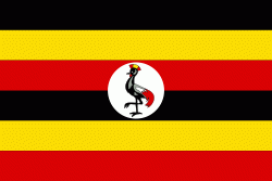
Flag of Uganda
Uganda (Yuganda in Ugandan languages), officially the Republic of Uganda (Jamhuri ya Uganda ), is a landlocked country in East Africa. The country is bordered to the east by Kenya, to the north by South Sudan, to the west by the Democratic Republic of the Congo, to the south-west by Rwanda, and to the south by Tanzania. The southern part of the country includes a substantial portion of Lake Victoria, shared with Kenya and Tanzania. Uganda is in the African Great Lakes region, lies within the Nile basin, and has a varied but a generally modified equatorial climate. It has a population of around 49.6 million, of which 8.5 million live in the capital and largest city of Kampala.

Uganda is named after the Buganda kingdom, which encompasses a large portion of the south of the country, including the capital Kampala and whose language Luganda is widely spoken throughout the country. From 1894, the area was ruled as a protectorate by the United Kingdom, which established administrative law across the territory. Uganda gained independence from the UK on 9 October 1962. The period since then has been marked by violent conflicts, including an eight-year-long military dictatorship led by Idi Amin.
Currency / Language  
ISO Currency Symbol Significant figures
UGX Ugandan shilling Sh 0
Neighbourhood - Country  
  •  Democratic Republic of the Congo 
  •  Kenya 
  •  Rwanda 
  •  South Sudan 
  •  Tanzania 
Administrative Subdivision
Country, State, Region,...