Jan Mayen (Jan Mayen)
Although administered separately, in the ISO 3166-1 standard, Jan Mayen and Svalbard are collectively designated as Svalbard and Jan Mayen, with the two-letter country code "SJ".
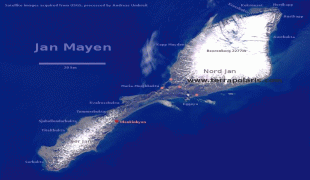
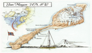
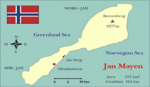
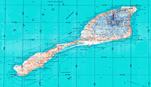
Jan Mayen Island has one exploitable natural resource, gravel, from a site located at Trongskaret. Other than this, economic activity is limited to providing services for employees of Norway's radio communications and meteorological stations located on the island. Jan Mayen has one unpaved airstrip, Jan Mayensfield, which is about 1585 m long. The 124.1 km coast has no ports or harbours, only offshore anchorages.
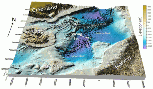
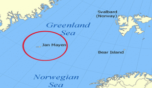
There are important fishing resources, and the existence of Jan Mayen establishes a large exclusive economic zone around it. A dispute between Norway and Denmark regarding the fishing exclusion zone between Jan Mayen and Greenland was settled in 1988 granting Denmark the greater area of sovereignty. Geologists suspect significant deposits of petroleum and natural gas lie below Jan Mayen's surrounding seafloors.
Map - Jan Mayen (Jan Mayen)
Map


Country - Svalbard_and_Jan_Mayen
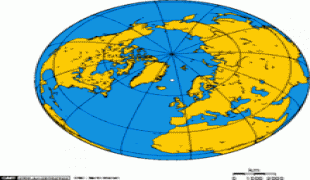
Svalbard and Jan Mayen (Svalbard og Jan Mayen, ISO 3166-1 alpha-2: SJ, ISO 3166-1 alpha-3: SJM, ISO 3166-1 numeric: 744) is a statistical designation defined by ISO 3166-1 for a collective grouping of two remote jurisdictions of Norway: Svalbard and Jan Mayen. While the two are combined for the purposes of the International Organization for Standardization (ISO) category, they are not administratively related. This has further resulted in the country code top-level domain .sj being issued for Svalbard and Jan Mayen, and ISO 3166-2:SJ. The United Nations Statistics Division also uses this code, but has named it the Svalbard and Jan Mayen Islands.
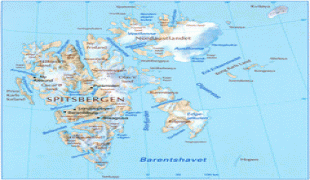
Svalbard is an archipelago in the Arctic Ocean under the sovereignty of Norway, but is subject to the special status granted by the Svalbard Treaty. Jan Mayen is a remote island in the Arctic Ocean; it has no permanent population and is administered by the County Governor of Nordland. Svalbard and Jan Mayen have in common that they are the only integrated parts of Norway not allocated to counties.
Svalbard is an archipelago in the Arctic Ocean under the sovereignty of Norway, but is subject to the special status granted by the Svalbard Treaty. Jan Mayen is a remote island in the Arctic Ocean; it has no permanent population and is administered by the County Governor of Nordland. Svalbard and Jan Mayen have in common that they are the only integrated parts of Norway not allocated to counties.
Currency / Language
| ISO | Language |
|---|---|
| NO | Norwegian language |
| RU | Russian language |