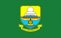
Jambi (Provinsi Jambi)
 |
 |
Jambi was the site of the Melayu kingdom that engaged in trade throughout the Strait of Malacca and beyond. It was recorded as having sent a mission to China in 644 CE. It seems to have been annexed by Srivijaya by 685 CE, but seemingly tried to declare its independence in the 9th century. Jambi succeeded Palembang, its southern economic and military rival, as the major player in trade in the Malacca straits. After the 1025 Chola raids in Southeast Asia, Jambi still sent missions to China.
In the early decades of the Dutch presence in the region (see Dutch East India Company in Indonesia), when the Dutch were one of several traders competing with the British, Chinese, Arabs, and Malays, the Jambi Sultanate profited from trade in pepper with the Dutch. This relationship declined by about 1770, and the sultanate had little contact with the Dutch for about sixty years.
In 1833, minor conflicts with the Dutch (the Indonesian colonial possessions of which were now nationalised as the Dutch East Indies) who were well established in Palembang, meant the Dutch increasingly felt the need to control the actions of Jambi. They coerced Sultan Facharudin to agree to greater Dutch presence in the region and control over trade, although the sultanate remained nominally independent. In 1858 the Dutch, apparently concerned over the risk of competition for control from other foreign powers, invaded Jambi with a force from their capital Batavia. They met little resistance, and Sultan Taha fled upriver, to the inland regions of Jambi. The Dutch installed a puppet ruler, Nazarudin, in the lower region, which included the capital city. For the next forty years Taha maintained the upriver kingdom, and slowly reextended his influence over the lower regions through political agreements and marriage connections. In 1904, however, the Dutch were stronger and, as a part of a larger campaign to consolidate control over the entire archipelago, soldiers finally managed to capture and kill Taha, and in 1906, the entire area was brought under direct colonial management.
Following the death of Jambi sultan, Taha Saifuddin, on 27 April 1904 and the success of the Dutch controlled areas of the Sultanate of Jambi, Jambi then set as the Residency and entry into the territory Nederlandsch Indie. Jambi's first Resident OL Helfrich was appointed by the governor general under Dutch Decree No. 20, dated 4 May 1906, with his inauguration held on 2 July 1906.
In 1945, Sumatra comprised a single province, but in 1948 this was divided into three provinces, including the province of Central Sumatra (which included present-day Jambi Province). In 1957 this short-lived province was itself divided, and Jambi was created as an independent Province.
Map - Jambi (Provinsi Jambi)
Map
Country - Indonesia
 |
 |
| Flag of Indonesia | |
As the world's third largest democracy, Indonesia is a presidential republic with an elected legislature. It has 38 provinces, of which nine have special status. The country's capital, Jakarta, is the world's second-most populous urban area. Indonesia shares land borders with Papua New Guinea, East Timor, and the eastern part of Malaysia, as well as maritime borders with Singapore, Vietnam, Thailand, the Philippines, Australia, Palau, and India. Despite its large population and densely populated regions, Indonesia has vast areas of wilderness that support one of the world's highest level of biodiversity.
Currency / Language
| ISO | Currency | Symbol | Significant figures |
|---|---|---|---|
| IDR | Indonesian rupiah | Rp | 2 |
| ISO | Language |
|---|---|
| NL | Dutch language |
| EN | English language |
| ID | Indonesian language |
| JV | Javanese language |


