Isla del Sol (Isla del Sol)
Isla del Sol (Island of the Sun) is an island in the southern part of Lake Titicaca. It is part of Bolivia, and specifically part of the La Paz Department. Geographically, the terrain is harsh; it is a rocky, hilly island with many eucalyptus trees. There are no motor vehicles or paved roads on the island. The main economic activity of the approximately 800 families on the island is farming, with fishing and tourism augmenting the subsistence economy. Of the several villages, Yumani and Challapampa are the largest.
There are over 80 ruins on the island. Most of these date to the Inca period circa the 15th century AD. Archaeologists have discovered evidence that people lived on the island as far back as the third millennium BC. Many hills on the island contain agricultural terraces, which adapt steep and rocky terrain to agriculture. Among the ruins on the island are Titi Qala (Aymara titi Andean mountain cat; lead, lead-colored, qala stone, "mountain cat stone" or "lead stone", also spelled Titikala), a labyrinth-like building called Chinkana, Q'asa Pata, and Pillkukayna. In the religion of the Incas, it was believed that the sun god was born here.
The Aymara name for the island is Titi'kaka. The original meaning of this word is not known. Some linguists and archaeologists believe the name to be a corruption of titi (Andean mountain cat; lead, lead-colored) and qala (rock). In the 1612 Aymara-Spanish dictionary of Ludovico Bertonio, the phrase Tahksi kala is listed as "piedra fundamental" or "foundation stone" possibly alluding to the origin story of the Inca that the Sun and Moon were born in the lake.
Map - Isla del Sol (Isla del Sol)
Map
Country - Bolivia
 |
 |
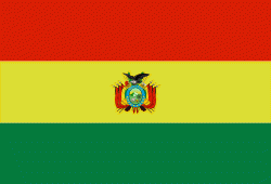
| Flag of Bolivia | |
The sovereign state of Bolivia is a constitutionally unitary state, divided into nine departments. Its geography varies from the peaks of the Andes in the West, to the Eastern Lowlands, situated within the Amazon basin. One-third of the country is within the Andean mountain range. With 1098581 km2 of area, Bolivia is the fifth largest country in South America, after Brazil, Argentina, Peru, and Colombia (and alongside Paraguay, one of the only two landlocked countries in the Americas), the 27th largest in the world, the largest landlocked country in the Southern Hemisphere, and the world's seventh largest landlocked country, after Kazakhstan, Mongolia, Chad, Niger, Mali, and Ethiopia.
Currency / Language
| ISO | Currency | Symbol | Significant figures |
|---|---|---|---|
| BOB | Boliviano | Bs | 2 |
| ISO | Language |
|---|---|
| AY | Aymara language |
| QU | Quechua language |
| ES | Spanish language |


