Sazan Island (Ishulli i Sazanit)
Sazan (Sazani) is an Albanian uninhabited island in the Mediterranean Sea. The largest of Albania's islands, it is a designated military exclusion zone; it lies in a strategically important location between the Strait of Otranto and the mouth of the Bay of Vlorë, marking the border between the Adriatic and Ionian seas. The island has a surface area of 5.7 km2. It is 4.8 km long and 2 km wide, and its coastline measures about 15 km.
In 2010, 2721.87 ha of the island's surrounding marine area was designated as the Karaburun-Sazan Marine Park. In clear weather, Sazan is sometimes visible from the coast of Salento, Italy, to its west. The island has been open to the public since July 2015.
Sazan was known as Sason (Σάσων) to the ancient Greeks, and Saso to the ancient Romans. Pseudo Scylax mentioned it in the Periplus. And Polybius wrote that there had been a military encounter there in 215 BC between the forces of Philip V of Macedon and the Romans. The island was part of the Roman Empire, and later came under Byzantine rule. In 1279, it was captured by the Anjou of Naples, and in the 14th century it was held by Albanian lords, often under the protection of the Republic of Venice.
Around 1400, the Ottomans captured it, but by 1696 it was controlled by the Venetians. In 1815, it came under the protection of Britain along with the Ionian Islands, which were made an autonomous republic.
In 1864, the island was ceded to Greece along with the rest of the Ionian Islands. It was considered part of Diapontia Islands. But Greece did not occupy it, and it came under the de facto control of the Ottomans. It was not until the First Balkan War, in 1912, that Greece landed soldiers on the island and formally claimed it, calling it Sasona (Σάσωνα). After the end of the Second Balkan War in 1913, Italy and Austria-Hungary pressed Greece to evacuate the southern part of modern Albania and the island. Due to the risk of starting a war with Italy, Greece evacuated it.
Italy in turn occupied it on 30 October 1914, and established a military commander on the island, which is called Saseno in Italian. This was later ratified on 26 April 1915 by the secret Treaty of London. After World War I, Albania formally ceded the island to Italy on 2 September 1920 as part of the Albano-Italian protocol.
The island was part of Italy from 1920 until after World War II, administratively part of Lagosta, in the province of Zara. In those years the Italian authorities built a lighthouse and some naval fortifications, and populated the island with a few families of fishermen relocated from Apulia. The island was united to the Italian Governatorate of Dalmatia in 1941 during World War II and ceded to Albania on 10 February 1947, under the postwar peace treaty with Italy.
Map - Sazan Island (Ishulli i Sazanit)
Map


Country - Albania
 |
 |
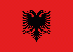
| Flag of Albania | |
Albania has been inhabited by different civilisations over time, such as the Illyrians, Thracians, Ancient Greeks, Romans, Byzantines, Venetians, and Ottomans. The Albanians established the autonomous Principality of Arbër in the 12th century. The Kingdom of Albania and Principality of Albania formed between the 13th and 14th centuries. Prior to the Ottoman conquest of Albania in the 15th century, the Albanian resistance to Ottoman expansion into Europe led by Skanderbeg won them acclaim over most of Europe. Albania remained under Ottoman rule for nearly five centuries, during which many Albanians (known as Arnauts) attained high-ranking offices in the empire, especially in the Southern Balkans and Egypt. Between the 18th and 19th centuries, cultural developments, widely attributed to Albanians having gathered both spiritual and intellectual strength, conclusively led to the Albanian Renaissance. After the defeat of the Ottomans in the Balkan Wars, the modern nation state of Albania declared independence in 1912. In the 20th century, the Kingdom of Albania was invaded by Italy, which formed Greater Albania before becoming a protectorate of Nazi Germany. Enver Hoxha formed the People's Socialist Republic of Albania after World War II, modeled under the terms of Hoxhaism. The Revolutions of 1991 concluded the fall of communism in Albania and eventually the establishment of the current Republic of Albania.
Currency / Language
| ISO | Currency | Symbol | Significant figures |
|---|---|---|---|
| ALL | Albanian lek | L | 2 |
| ISO | Language |
|---|---|
| SQ | Albanian language |
| EL | Greek language |