Tchongorove Airport (Iguela)
Tchongorove Airport is an airstrip serving Iguéla, a sport fishing center in Ogooué-Maritime Province, Gabon. The runway is on a narrow peninsula on the ocean side of the Iguéla Lagoon
The Gavilo Lodge has a 500 m sand airstrip 2 km north of Tchongorove Airport, on the mainland side of the lagoon.
* List of airports in Gabon
* Transport in Gabon
* Transport in Gabon
The Gavilo Lodge has a 500 m sand airstrip 2 km north of Tchongorove Airport, on the mainland side of the lagoon.
* List of airports in Gabon
* Transport in Gabon
* Transport in Gabon
| IATA Code | IGE | ICAO Code | FOOI | FAA Code | |
|---|---|---|---|---|---|
| Telephone | Fax | ||||
| Home page |
Map - Tchongorove Airport (Iguela)
Map
Country - Gabon
 |
 |
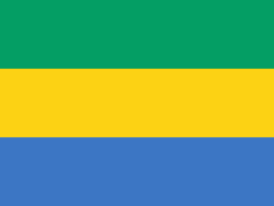
| Flag of Gabon | |
Since its independence from France in 1960, the sovereign state of Gabon has had three presidents. In the 1990s, it introduced a multi-party system and a democratic constitution that aimed for a more transparent electoral process and reformed some governmental institutions. Despite this, the Gabonese Democratic Party (PDG) remains the dominant party. With petroleum and foreign private investment, it has the fourth highest HDI in the region (after Mauritius, Seychelles and South Africa) and the fifth highest GDP per capita (PPP) in all of Africa (after Seychelles, Mauritius, Equatorial Guinea and Botswana). Its GDP grew by more than 6% per year from 2010 to 2012.
Currency / Language
| ISO | Currency | Symbol | Significant figures |
|---|---|---|---|
| XAF | Central African CFA franc | Fr | 0 |
| ISO | Language |
|---|---|
| FR | French language |


