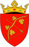
Hîncești is a district (raion) of Moldova, with the city of Hîncești as its administrative center. As of 1 January 2011, its population was 122,000.
The district has been inhabited since the Stone Age (40,000–30,000 BC). On the territory of the present localities Rusca and Anina many cemeteries and settlements pertaining to the native Getae culture (4th–3rd centuries BC) have been discovered. Localities with the earliest historical attestation are Secăreni, Leușeni, Lăpușna, and Ciuciuleni, which were first attested in the period 1420–1430. During the 15th–18th centuries, the district was part of Lăpușna. Tirgul Lăpușnei was the administrative center, headed by a pârcălab (governor). Lăpușna existed as a fair in the 14th century. A branch of the Moldovan Road passed by Lapusna, linking the economic centers of Transylvania and Poland to the North Pontic cities. The branch continued on over the Danube, in Dobruja, to Constantinople. Lăpușna Fair was a resting place for merchants, where they paid a small customs, besides the great customs from abroad. In 1489, Lăpușna was expressly recorded as a fair, thereby underlining its economic importance. After the conquest of Cetatea Albă and Chilia by the Turks, and Bugeac by Noha Tatars, the southern border of Moldova was moved farther north, closer to the region. Lăpușna has served as a resting place for many foreign travelers, officials, missionaries, ambassadors, and merchants. In 1812, after the Russo-Turkish War, the Russian Empire occupied the region of Basarabia, leading to an intense russification of the native population. In 1918, after the collapse of the Russian Empire, Bessarabia united with Romania. In this period (1918–1940 and 1941–1944), the district was part of the Lăpușna County. In 1940, after the Molotov-Ribbentrop Treaty, Basarabia was occupied by the USSR. In 1991, as a result of the proclamation of Independence of Moldova, the region became part of Lăpușna County (1991–2003), and in 2003 it became an administrative unit of Moldova.


