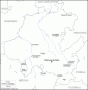
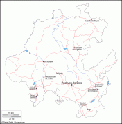
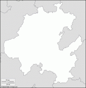
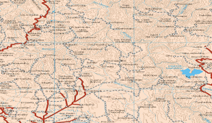
Hidalgo (Estado de Hidalgo)
 |
 |
In 1869, Benito Juárez created the State of Hidalgo and made Pachuca its capital city; Juárez would add the name "de Soto" in recognition of Manuel Fernando Soto, who is considered the most important driving force in creating the state. The state was named after Miguel Hidalgo y Costilla, the initiator of the Mexican War of Independence.
The indigenous peoples of the state, such as the Otomi, retain much of their traditional culture. In addition to Mexicans of Spanish descent, there are also notable immigrant cultures: those of the descendants of Cornish miners from Cornwall (located in South West England) who arrived in the 19th century, a few self-proclaimed Italian descendants, and a small Jewish enclave which claims to be descended from Sephardi Jews which came to New Spain in the 16th century.
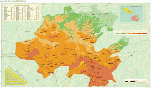
Hidalgo is known for its mountainous terrain, though part of the state is on a coastal plain. With a population of 2.858 million and an area of roughly 20,813 square km, Hidalgo is one of Mexico's smaller states. The state contains a number of ecotourism, cultural and archeological attractions including the Huasteca area, the ruins of Tula, natural hot water springs, old haciendas and mountain ranges.
The modern day state of Hidalgo is located within the pre-Hispanic region of Mesoamerica. Numerous migrations of indigenous people took place through here, mostly arriving or passing through from the north, with many eventually settling in the Valley of Mexico. The Toltecs initially settled in Xochicoatlán, now the municipality of Molango, at the beginning of the 7th century. From here they dispersed to locales such as Huejutla and Tollatzingo (now called Tulancingo) where they eventually had their capital of Tollan, today known as Tula.
The Toltecs were eventually overrun by Chichimecas, who established their capital in Metztitlán. The Aztecs arrived in the 12th century, initially establishing themselves in Mixquiahuala, then founding Tizayuca later. Eventually, the Aztecs took over most of what is now the southern portion of the state, incorporating it into the Aztec Empire.
After the Spanish conquest of the Aztec Empire, the conquistadors carved out territories for themselves from Aztec lands. Hernán Cortés took possession of lands to the northeast of Mexico City extending into modern Hidalgo state. Evangelization efforts followed soon thereafter with the first Franciscans arriving in 1523. This changed the social, economic and cultural structure of the areas as the Spanish took control of natural resources — especially minerals — and the labor the Indians provided. It also led to a massive decrease in the native population, especially during the governorship of the area by Nuño Beltrán de Guzmán. By the 18th century, the economy of the Hidalgo area was dominated by mining and agricultural haciendas. Much of the agricultural production during the colonial period was centered on livestock such as sheep and pigs as well as the making of pulque from the native maguey plant. However, the mining of silver, gold and other metals in the Pachuca/Real del Monte area would prove to be the economic backbone of the area through the colonial period and into most of post Independence period. The fortunes of the mining industry would rise and fall during the colonial period; one of the most productive eras came under the control of Pedro Romero de Terreros in the 18th century.
Despite Spanish control and evangelization efforts since the 16th century, many of the Otomi and other indigenous groups of the area had not been fully subjugated by the 18th century, especially in the Sierra Gorda and Sierra Baja areas. These groups and others manage a significant amount of success in maintaining cultural, political and economic autonomy through the colonial period. Much of the state still maintains a number of strong indigenous identities.
Many in Hidalgo, especially the indigenous, supported Miguel Hidalgo y Costilla’s cause, providing leaders such as José María Correa and José Antonio Magos, both of whom were active in the Mezquital Valley area. However, no major battles of the Mexican War of Independence were fought in the state. Instead, a number of smaller operations against local Spaniards were conducted. When the war ended in 1821, the country was divided into a number of states. The modern state of Hidalgo was initially part of the very large territory called “Mexico” (which extended in all directions from Mexico City), which eventually was split with the remaining portion becoming the modern State of Mexico. What is now Hidalgo was originally the districts of Tula, Tulancingo and Huejutla of the former entity. The state of Hidalgo would not be formally created until the 1860s.
The economic consequences to the mines of Pachuca and Real del Monte during the War of Independence were ruinous. In 1824, British mining companies were brought in to revive the sector. The British introduced steam-powered machinery and other modern techniques as well as a large quantity of Cornish miners. Many of these Cornish miners stayed and English names and foods such as pasties (called “pastes” in Spanish) help define the state, especially in the Pachuca and Real del Monte areas. These Englishmen were forced to sell their interest to Mexican capitalists in 1849, and the mining sector fell again.
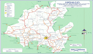
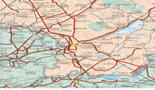
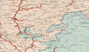
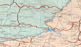
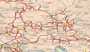
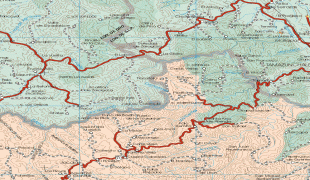
Map - Hidalgo (Estado de Hidalgo)
Map


Country - Mexico


Currency / Language
| ISO | Currency | Symbol | Significant figures |
|---|---|---|---|
| MXV | Mexican Unidad de Inversion | 2 | |
| MXN | Mexican peso | $ | 2 |
| ISO | Language |
|---|---|
| ES | Spanish language |