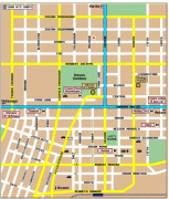
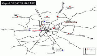
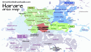
Harare
 |
 |
The city was founded in 1890 by the Pioneer Column, a small military force of the British South Africa Company, and named Fort Salisbury after the UK Prime Minister Lord Salisbury. Company administrators demarcated the city and ran it until Southern Rhodesia achieved responsible government in 1923. Salisbury was thereafter the seat of the Southern Rhodesian (later Rhodesian) government and, between 1953 and 1963, the capital of the Central African Federation. It retained the name Salisbury until 1982, when it was renamed Harare on the second anniversary of Zimbabwean independence from the United Kingdom.
Long the commercial capital of Zimbabwe, Harare has seen economic ups and downs since the 2000s. It remains an important centre of commerce, government, finance, real estate, manufacturing, healthcare, design, education, art, culture, tourism, agriculture, mining and regional affairs. Harare has the second-highest number of embassies in Southern Africa and serves as the location of the African headquarters of the World Health Organization, which it shares with Brazzaville.
Harare has hosted multiple international conferences and events, including the 1995 All-Africa Games and the 2003 Cricket World Cup. In 2018, Harare was ranked as a Gamma world city. The city's marquee festival is the Harare International Festival of the Arts, modelled on the Edinburgh Festival and one of the largest arts festivals in the southern hemisphere. It is also home to Dynamos FC, the club with the most titles in Zimbabwean football.
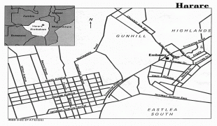
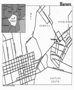
The Pioneer Column, a military volunteer force of settlers organised by Cecil Rhodes, founded the city on 12 September 1890 as a fort. They originally named the city Fort Salisbury after The 3rd Marquess of Salisbury, then-Prime Minister of the United Kingdom, and it subsequently became known simply as Salisbury. The Salisbury Polo Club was formed in 1896. It was declared to be a municipality in 1897 and it became a city in 1935. The area at the time of founding of the city was poorly drained and earliest development was on sloping ground along the left bank of a stream that is now the course of a trunk road (Julius Nyerere Way). The first area to be fully drained was near the head of the stream and was named Causeway as a result. This area is now the site of many of the most important government buildings, including the Senate House and the Office of the Prime Minister, now renamed for the use of the President after the position was abolished in January 1988.
Salisbury was the capital of the self-governing British colony of Southern Rhodesia from 1923, and of the Federation of Rhodesia and Nyasaland from 1953 to 1963. Ian Smith's Rhodesian Front government declared Rhodesia independent from the United Kingdom on 11 November 1965, and proclaimed the Republic of Rhodesia in 1970. Subsequently, the nation became the short-lived state of Zimbabwe Rhodesia, it was not until 18 April 1980 that the country was internationally recognised as independent as the Republic of Zimbabwe.
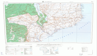
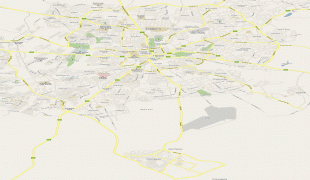
Map - Harare
Map


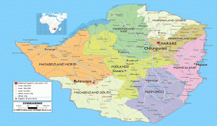
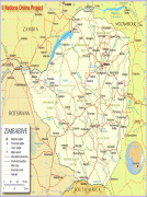
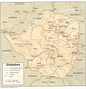
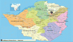

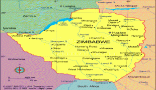
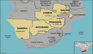
Country - Zimbabwe
 |
 |
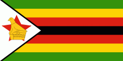
| Flag of Zimbabwe | |
The British South Africa Company of Cecil Rhodes demarcated the Rhodesia region in 1890 when they conquered Mashonaland and later in 1893 Matabeleland after a fierce resistance by Matabele people known as the First Matabele War. Company rule ended in 1923 with the establishment of Southern Rhodesia as a self-governing British colony. In 1965, the white minority government unilaterally declared independence as Rhodesia. The state endured international isolation and a 15-year guerrilla war with black nationalist forces; this culminated in a peace agreement that established universal enfranchisement and de jure sovereignty as Zimbabwe in April 1980. Zimbabwe then joined the Commonwealth of Nations, from which it was suspended in 2002 for breaches of international law by its government under Robert Mugabe and from which it withdrew in December 2003.
Currency / Language
| ISO | Currency | Symbol | Significant figures |
|---|---|---|---|
| ZWL | Zimbabwean dollar | 2 |
| ISO | Language |
|---|---|
| SN | Shona language |