Grigoriopol (Hryhoriopol)
Grigoriopol (, Moldovan Cyrillic: Григориопол, Григорио́поль, Григоріо́поль) is a town in the Administrative-Territorial Units of the Left Bank of the Dniester, Moldova. It is the seat of the Grigoriopol District of Transnistria. The city is located on the left (eastern) bank of the river Dniester at 47.15°N, 29.3°W, in central Transnistria. Grigoriopol is composed of the city itself, and a small village Crasnoe (Красное). The town itself had a population of 11,473 in 2004.
In 1996 and in 2002, the town was the centre of a dispute regarding the attempts of local Moldavian inhabitants to use the Romanian language (written with Latin script characters) in the local Moldavian school, which is against the policy of the government of Transnistria. The Transnistrian press attacked the local authorities "that allowed the fifth column of Moldova in Transnistria to operate". The head of the Parent-Teacher Association of the Moldavian school, Mihai Speian, was arrested by the Transnistrian authorities on August 28th, 2002. He was released on September 12th, following a protest by the Organization for Security and Co-operation in Europe mission in Moldova. The school was moved to the village of Doroțcaia, Dubăsari district, which is in the area controlled by the Republic of Moldova.
In 1989, the population of the city was 11,712. According to the 2004 Census in Transnistria, the city itself had 11,473 inhabitants, including 5,570 Moldavians, 3,275 Russians, 2,248 Ukrainians, 83 Germans, 67 Belarusians, 63 Bulgarians, 46 Armenians, 39 Poles, 26 Gagauzians, 14 Jews, and 42 others and non-declared.
* Konstantin Gedroits (1872 in Grigoriopol – 1932), Ukrainian painter and geologist
* Oleksandr Danylyuk (born 1975 in Grigoriopol), Ukrainian politician and former finance minister of Ukraine
* Roman Rozna (born 1976 in Grigoriopol), a male hammer thrower from Moldova, competed in the 2000, 2004 and 2008 Summer Olympics
Map - Grigoriopol (Hryhoriopol)
Map


Country - Moldova
 |
 |
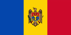
| Flag of Moldova | |
Most of Moldovan territory was a part of the Principality of Moldavia from the 14th century until 1812, when it was ceded to the Russian Empire by the Ottoman Empire (to which Moldavia was a vassal state) and became known as Bessarabia. In 1856, southern Bessarabia was returned to Moldavia, which three years later united with Wallachia to form Romania, but Russian rule was restored over the whole of the region in 1878. During the 1917 Russian Revolution, Bessarabia briefly became an autonomous state within the Russian Republic. In February 1918, it declared independence and then integrated into Romania later that year following a vote of its assembly. The decision was disputed by Soviet Russia, which in 1924 established, within the Ukrainian SSR, a so-called Moldavian autonomous republic on partially Moldovan-inhabited territories to the east of Bessarabia.
Currency / Language
| ISO | Currency | Symbol | Significant figures |
|---|---|---|---|
| MDL | Moldovan leu | L | 2 |
| ISO | Language |
|---|---|
| RO | Romanian language |
| RU | Russian language |
| TR | Turkish language |