Grand Port District (Grand Port District)
Grand Port is named after the village of 'Old Grand Port' which saw the first Dutch landing and the first port of the island. It is centered on the town of Mahébourg on the coast, inside the Grand Port Bay. Built by the Dutch and later taken over by the French, the town is a reminder of the colonial past of the island.
In 1810, a French squadron of frigates achieved an ultimately futile naval victory over a comparable British squadron at the Battle of Grand Port, near the Île de la Passe.
Map - Grand Port District (Grand Port District)
Map


Country - Mauritius
 |
 |
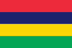
| Flag of Mauritius | |
Arab sailors were the first to discover the uninhabited island, around 975, and they called it Dina Arobi. In 1507, Portuguese sailors visited the uninhabited island. The island appears with the Portuguese names Cirne or Do-Cerne on early Portuguese maps. The Dutch took possession in 1598, establishing a succession of short-lived settlements over a period of about 120 years, before abandoning their efforts in 1710. France took control in 1715, renaming it Isle de France. In 1810, the United Kingdom seized the island, and four years later, in the Treaty of Paris, France ceded Mauritius and its dependencies to the United Kingdom. The British colony of Mauritius included Rodrigues, Agaléga, St. Brandon, the Chagos Archipelago, and, until 1906, the Seychelles. Mauritius and France dispute sovereignty over the island of Tromelin as the Treaty of Paris failed to mention it specifically. Mauritius remained a primarily plantation-based colony of the United Kingdom until independence in 1968.
Currency / Language
| ISO | Currency | Symbol | Significant figures |
|---|---|---|---|
| MUR | Mauritian rupee | ₨ | 2 |
| ISO | Language |
|---|---|
| EN | English language |
| FR | French language |