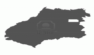
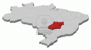
Goiás
 |
The history of Goiás dates back to the beginning of the 18th century, with the arrival of pioneers from São Paulo. The Rio Vermelho region was the first to be occupied, where Vila Boa (later renamed Goiás) was founded. The development and settlement of the state took place, in a more intensified way, starting in the 1930s with the founding of the new capital, Goiânia, and especially with the construction of Brasília in the 1950s.
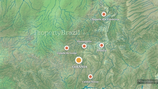
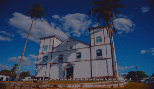
Goiás is characterized by a landscape of chapadões (plateaus). In the height of the drought season, from June to September, the lack of rain makes the level of the Araguaia River go down and exposes almost 2 km of beaches. At the Emas National Park in the municipality of Mineiros, it is possible to observe the typical fauna and flora from the region. At the Chapada dos Veadeiros the main attractions are the canyons, valleys, rapids and waterfalls. Other attractions include the historical city of Goiás and the hot springs of Caldas Novas.
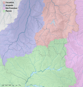
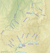
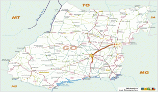
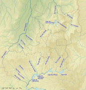
Goiás occupies a large plateau, the vast almost level surface of which stands between 750 and 900 m above sea level and forms the divide between three of Brazil's largest river systems: to the south, Goiás is drained by the Paranaíba river, a tributary of the Paraná River; to the east it is drained by tributaries of the São Francisco River; and northward the state is drained by the Araguaia River and the Tocantins River and their tributaries. Other major rivers in the state are the Meia Ponte, Aporé, São Marcos, Corumbá River, Claro, Maranhão, Paranã and Preto. None of these rivers is navigable except for short distances by small craft.
The state's highest point is Pouso Alto, at 1676 m above sea level, in the Chapada dos Veadeiros.
Goiás is covered with a woodland savanna known in Brazil as campo cerrado, although there are still tropical forests along the rivers. The climate of the plateau is tropical. Average monthly temperatures vary from 26 C in the warmest month to 22 C in the coldest. The year is divided into a rainy season (October–March) and a dry season (April–September). Average annual rainfall is about 1700 mm, but this varies due to elevation and microclimate. Some parts of the state, however, have small remnants of tropical Atlantic forest, that mostly appears around rivers and valleys.
The Great Central West Region, consisting of the states of Goiás, Mato Grosso, Mato Grosso do Sul, and the Federal District, is among the fastest-growing regions of Brazil. The population of Goiás state tripled in size in the period from 1950 to 1980 and is still growing very quickly. However, outside the Federal District and the Goiânia metropolitan region (with a population of over a million) most of Goiás is very thinly populated. The chief concentration of settlement is in the southeast, in the area of Goiânia (Goiânia and Aparecida de Goiânia), across the border from Minas Gerais (Catalão, Rio Verde, Jataí, and Caldas Novas), and around the Federal District (Formosa, Planaltina de Goiás, and Luziânia).
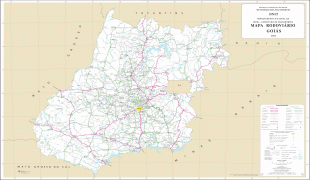
Map - Goiás
Map


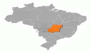
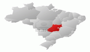


Country - Brazil


Currency / Language
| ISO | Currency | Symbol | Significant figures |
|---|---|---|---|
| BRL | Brazilian real | R$ | 2 |
| ISO | Language |
|---|---|
| EN | English language |
| FR | French language |
| PT | Portuguese language |
| ES | Spanish language |


