Glodeni District (Glodeni)
The oldest area in the district is the Cobani, which dates back to June 3, 1374. Other old localities include Balatina, Camenca, Cuhnești, and Iabloana, founded between 1429 and 1442. During the 15th–17th centuries Glodeni continued to develop as a trade and economic region, with a significant increase in population. In 1616, a district center was documented as Glodeni.
Since the 17th and 18th centuries, the region has been fueled by wars with the Polish–Lithuanian Commonwealth and the Ottoman and Russian Empires. In 1812, the region was occupied by the Russian Empire; with the local population of Moldovans and Ukrainians, Russians constitute 22 percent of the population. After the collapse of the Russian Empire in 1917, Bessarabia decided to unite with Romania. In 1940, Bessarabia was occupied by the USSR after the Molotov–Ribbentrop pact. From 1944 to 1991, the Glodeni District was part of the Moldavian Soviet Socialist Republic (MSSR). After the 1991 independence of Moldova, the Glodeni District was part of Bălți County until 2003, when it became a district.
Map - Glodeni District (Glodeni)
Map


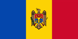
Country - Moldova
 |
 |
| Flag of Moldova | |
Most of Moldovan territory was a part of the Principality of Moldavia from the 14th century until 1812, when it was ceded to the Russian Empire by the Ottoman Empire (to which Moldavia was a vassal state) and became known as Bessarabia. In 1856, southern Bessarabia was returned to Moldavia, which three years later united with Wallachia to form Romania, but Russian rule was restored over the whole of the region in 1878. During the 1917 Russian Revolution, Bessarabia briefly became an autonomous state within the Russian Republic. In February 1918, it declared independence and then integrated into Romania later that year following a vote of its assembly. The decision was disputed by Soviet Russia, which in 1924 established, within the Ukrainian SSR, a so-called Moldavian autonomous republic on partially Moldovan-inhabited territories to the east of Bessarabia.
Currency / Language
| ISO | Currency | Symbol | Significant figures |
|---|---|---|---|
| MDL | Moldovan leu | L | 2 |
| ISO | Language |
|---|---|
| RO | Romanian language |
| RU | Russian language |
| TR | Turkish language |