Gitega Province (Gitega Province)
After Burundi attained full independence on 1 July 1962, there was a military coup d'état in which the king was overthrown and monarchy disbanded in 1966. When King Ntare V tried to reinstate his kingdom, he was assassinated in 1972 at the Royal Palace of Gitega.
On 26 April 1996, army attacks at Buhoro killed some 230 civilians. On 21 October, some 70 Tutsi students were burnt alive at Kibimba. In March 2007, President Pierre Nkurunziza announced that Burundi had plans to transfer the capital from Bujumbura to Gitega. According to him, the central location of the city makes it "an ideal place to better serve the majority of the population". The capital was moved on 24 December 2018.
Map - Gitega Province (Gitega Province)
Map


Country - Burundi
 |
 |
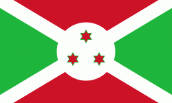
| Flag of Burundi | |
The Twa, Hutu and Tutsi peoples have lived in Burundi for at least 500 years. For more than 200 of those years, Burundi was an independent kingdom, until the beginning of the 20th century, when it became a German colony. After the First World War and Germany's defeat, the League of Nations "mandated" the territory to Belgium. After the Second World War, this transformed into a United Nations Trust Territory. Both Germans and Belgians ruled Burundi and Rwanda as a European colony known as Ruanda-Urundi. Burundi and Rwanda had never been under common rule until the time of European colonization of Africa.
Currency / Language
| ISO | Currency | Symbol | Significant figures |
|---|---|---|---|
| BIF | Burundian franc | Fr | 0 |
| ISO | Language |
|---|---|
| FR | French language |
| RN | Rundi language |