F. D. Roosevelt Airport (F. D. Roosevelt Airport)
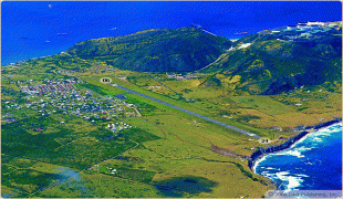
F. D. Roosevelt Airport is the airport located on the island of Sint Eustatius, Caribbean Netherlands. It was opened as "Golden Rock Airport" in 1946 and renamed for Franklin Delano Roosevelt. As of 2012, the only commercial aircraft that serves the island is the DHC-6 Twin Otter (can operate chartered flights with Britten-Norman Islander and Cessna 208 Caravan), although the runway can accommodate larger turboprop aircraft and some smaller jets. As of 2018, the largest aircraft type to operate at the airport is the ATR 42.
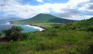
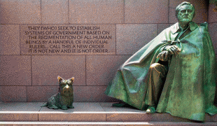
President Roosevelt had Dutch ancestors and in 1939 presented Sint Eustatius with a plaque in recognition of the "First Salute," the first official salute of the flag of the newly declared independent United States in 1776. Members of the Roosevelt family lived on St. Eustatius in the 18th century and had possessions on the island.
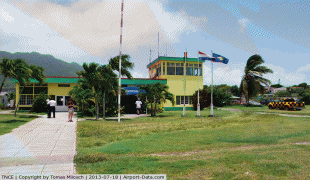
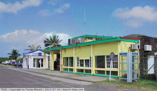
The airport is built to support small aircraft. A small single story terminal building processes passengers and baggage and also serves as the customs area. A two-story tower is attached, but the airport has no control tower. There are no jetways or services, and a small apron allows for aircraft passengers to disembark.
President Roosevelt had Dutch ancestors and in 1939 presented Sint Eustatius with a plaque in recognition of the "First Salute," the first official salute of the flag of the newly declared independent United States in 1776. Members of the Roosevelt family lived on St. Eustatius in the 18th century and had possessions on the island.
The airport is built to support small aircraft. A small single story terminal building processes passengers and baggage and also serves as the customs area. A two-story tower is attached, but the airport has no control tower. There are no jetways or services, and a small apron allows for aircraft passengers to disembark.
| IATA Code | EUX | ICAO Code | TNCE | FAA Code | |
|---|---|---|---|---|---|
| Telephone | Fax | ||||
| Home page |
Map - F. D. Roosevelt Airport (F. D. Roosevelt Airport)
Map


Country - Caribbean_Netherlands
 |
 |
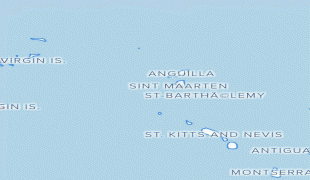
Bonaire (including the islet of Klein Bonaire) is one of the Leeward Antilles and is located close to the coast of Venezuela. Sint Eustatius and Saba are in the main Lesser Antilles group and are located south of Sint Maarten and northwest of Saint Kitts and Nevis. The Caribbean Netherlands has a population of 25,157 as of January 2019.
Currency / Language
| ISO | Currency | Symbol | Significant figures |
|---|---|---|---|
| USD | United States dollar | $ | 2 |
| ISO | Language |
|---|---|
| NL | Dutch language |
| EN | English language |