El Matareya (Al Maţarīyah)
 |
 |
The region should not be confused with the district of El Matareya in Cairo. El Matareya has a population of around 300,000 inhabitants, and consists of two main districts: El-Ghasna and El-Okbiyine. It was announced as a separate city in the 1930s, with many villages following in it.
The city consisted of two main islands named El-Ghasna and El-Okbiyine. They were distinct islands until 1903 when the government issued a decree to unite both islands under the name El Matareya city. Transportation between the two islands was via wooden boats until the waterway separating the islands was dried up. The first brick houses in the city were built in the 1750s with the roofs being made of wood.
The city played a heroic role during the French campaign on Egypt, where the fishermen joined the resistance forces led by the Egyptian leader of the struggle against colonialism in this region, Sheikh Hassan Tobar. When the French battleships moved from Damietta towards El Matareya to attack, they were surprised by 100 fishermen boats opposing them. At last, the city was occupied by the French in October 1798.
The fishermen of El Matareya played an important role in the digging of the Suez Canal, since they delivered water from the city to the workers in Port Said.
Map - El Matareya (Al Maţarīyah)
Map


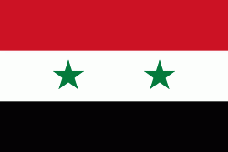
Country - United_Arab_Republic
 |
 |
| Flag of Egypt | |
The republic was led by Egyptian President Gamal Abdel Nasser. The UAR was a member of the United Arab States, a loose confederation with the Mutawakkilite Kingdom of Yemen, which was dissolved in 1961.
Currency / Language
| ISO | Currency | Symbol | Significant figures |
|---|---|---|---|
| EGP | Egyptian pound | £ or جم | 2 |
| ISO | Language |
|---|---|
| AR | Arabic language |
| EN | English language |
| FR | French language |