Map - Edineţ District (Raionul Edineţ)

Edineţ District (Raionul Edineţ)
Edineț is a district (raion) in the north-west of Moldova, with the administrative center at Edineț. The other major city is Cupcini. As of 1 January 2011, its population was 82,900.

The district is bordered by Briceni District to the north, Ocnița District to the northeast, Dondușeni District to the east, Rîșcani District to the south, and Romania to the west across the Prut river. Most important rivers crossing the district are: Ciuhur (90 km), Racovăț (68 km) and Draghiște (67 km) the latter being the main Racovăț's tributary. All rivers of district flowing into the Prut. The Moldavian Plateau occupies the majority district territory. It has a flat relief and less fragmented. Highest point of Edineț District is located near the village Clișcăuți in northeast of district, reaching 275 meters.

In the central western part of district covers a strip of coral, which called toltre. They are composed of limestone organogenous formed on the bottom of former Sarmatian sea having an age of 15–20 million years. In now coming to the surface like massive reefs with maximum height of 80–100 meters. In these rocks are many caves that served as shelter for Stone Age man.

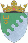
 
Map - Edineţ District (Raionul Edineţ)
Map
Openstreetmap - Map - Edineţ District
Openstreetmap
Map - Edineţ District - Esri.WorldImagery
Esri.WorldImagery
Map - Edineţ District - Esri.WorldStreetMap
Esri.WorldStreetMap
Map - Edineţ District - OpenStreetMap.Mapnik
OpenStreetMap.Mapnik
Map - Edineţ District - OpenStreetMap.HOT
OpenStreetMap.HOT
Map - Edineţ District - CartoDB.Positron
CartoDB.Positron
Map - Edineţ District - CartoDB.Voyager
CartoDB.Voyager
Map - Edineţ District - OpenMapSurfer.Roads
OpenMapSurfer.Roads
Map - Edineţ District - Esri.WorldTopoMap
Esri.WorldTopoMap
Map - Edineţ District - Stamen.TonerLite
Stamen.TonerLite
Country - Moldova
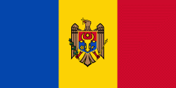
Flag of Moldova
Moldova (, sometimes ; ), officially the Republic of Moldova (Republica Moldova), is a landlocked country in Eastern Europe. It is bordered by Romania to the west and Ukraine to the north, east, and south. The unrecognised state of Transnistria lies across the Dniester river on the country's eastern border with Ukraine. Moldova's capital and largest city is Chișinău.

Most of Moldovan territory was a part of the Principality of Moldavia from the 14th century until 1812, when it was ceded to the Russian Empire by the Ottoman Empire (to which Moldavia was a vassal state) and became known as Bessarabia. In 1856, southern Bessarabia was returned to Moldavia, which three years later united with Wallachia to form Romania, but Russian rule was restored over the whole of the region in 1878. During the 1917 Russian Revolution, Bessarabia briefly became an autonomous state within the Russian Republic. In February 1918, it declared independence and then integrated into Romania later that year following a vote of its assembly. The decision was disputed by Soviet Russia, which in 1924 established, within the Ukrainian SSR, a so-called Moldavian autonomous republic on partially Moldovan-inhabited territories to the east of Bessarabia.
Currency / Language  
ISO Currency Symbol Significant figures
MDL Moldovan leu L 2
Neighbourhood - Country  
  •  Romania 
  •  Ukraine 
Administrative Subdivision
City, Village,...