East End (East End)
East End is one of the fourteen Districts of Anguilla. Its population at the 2011 census was 671.
There is one government school in the town, Morris Vanterpool Primary School. Albena Lake-Hodge Comprehensive School in The Valley serves secondary students.
There is one government school in the town, Morris Vanterpool Primary School. Albena Lake-Hodge Comprehensive School in The Valley serves secondary students.
Map - East End (East End)
Map


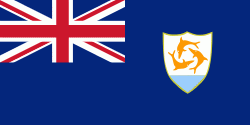
Country - Anguilla
 |
 |
The native Arawak name for the island was Malliouhana.
Currency / Language
| ISO | Currency | Symbol | Significant figures |
|---|---|---|---|
| XCD | East Caribbean dollar | $ | 2 |
| ISO | Language |
|---|---|
| EN | English language |