Dushanbe
 |
In ancient times, what is now or is close to modern Dushanbe was settled by various empires and peoples, including Mousterian tool-users, various neolithic cultures, the Achaemenid Empire, Greco-Bactria, the Kushan Empire, and the Hephthalites. In the Middle Ages, more settlements began near modern-day Dushanbe such as Hulbuk and its famous palace. From the 17th to early 20th century, Dushanbe grew into a market village controlled at times by the Beg of Hisor, Balkh, and finally Bukhara, before being conquered by the Russian Empire. Dushanbe was captured by the Bolsheviks in 1922, and the town was made the capital of the Tajik Autonomous Soviet Socialist Republic in 1924, which commenced Dushanbe's development and rapid population growth that continued until the Tajik Civil War. After the war, the city became capital of an independent Tajikistan and continued its growth and development into a modern city, today home to many international conferences.
Dushanbe's modern culture had its start in the 1920s, where Soviet music, opera, theater, sculpture, film, and sports all began. Music, primarily shashmaqam before the Soviet invasion, took off in the city due to Russian influence and local opera houses and symphonies. Tajik figures such as Sadriddin Ayni contributed greatly to the development of Dushanbe's literature, which went through many changes during and after the Soviet period. Theater and film both saw their beginnings in the 1930s and were heavily influenced by Soviet trends. The architecture of Dushanbe, once neoclassical, transitioned to a minimalist and eventually modern style. The city is a center for newspapers, radio stations, and television of the country, with almost 200 newspapers and more than a dozen television studios operating in 1999.
Much of Dushanbe's education system dates from Soviet times and has a legacy of state control; today the largest university in Dushanbe, the Tajik National University, is funded by the government. Dushanbe International Airport is the primary airport serving the city. Other forms of transport include the trolleybus system dating from 1955, the small rail system, and the roads that traverse the city. Dushanbe's electricity is primarily hydroelectric, produced by the Nurek Dam, and the aging water system dates from 1932. Tajikistan's healthcare system is concentrated in Dushanbe, meaning that the major hospitals of the country are in the city. The city makes up 20% of Tajikistan's GDP and has large industrial, financial, retail, and tourism sectors. Parks and main sights of the city include Victory Park, Rudaki Park, the Tajikistan National Museum, the Dushanbe Flagpole, and the Tajikistan National Museum of Antiquities.
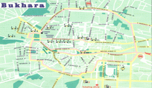
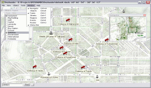
Dushanbe was the location of a large bazaar that operated on Mondays. This gave rise to the name Dushanbe-Bazar (Душанбе Бозор, Dushanbe Bozor) from Dushanbe, which means Monday in the Persian language – literally, the second day (du) following Saturday (shanbe). Its previous name was Stalinabad (the city of Stalin), but renamed as a result of de-Stalinization.
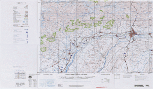
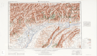
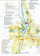
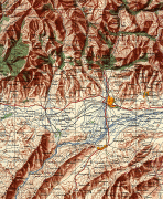
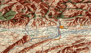
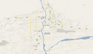
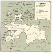
Map - Dushanbe
Map


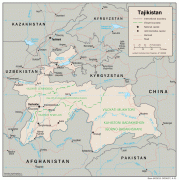

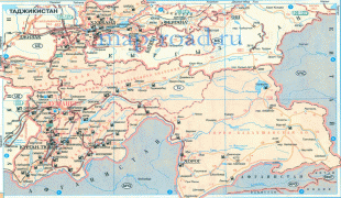
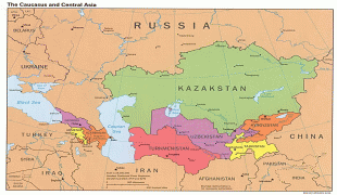

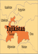
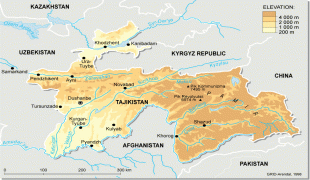
Country - Tajikistan
 |
 |
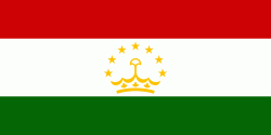
| Flag of Tajikistan | |
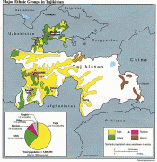
The territory that now constitutes Tajikistan was previously home to several ancient cultures, including the city of Sarazm of the Neolithic and the Bronze Age and was later home to kingdoms ruled by people of different faiths and cultures, including the Oxus civilization, Andronovo culture, Buddhism, Nestorian Christianity, Hinduism, Zoroastrianism, Manichaeism, and Islam. The area has been ruled by numerous empires and dynasties, including the Achaemenid Empire, Sasanian Empire, Hephthalite Empire, Samanid Empire, and Mongol Empire. After being ruled by the Timurid Empire and Khanate of Bukhara, the Timurid Renaissance flourished. The region was later conquered by the Russian Empire and subsequently by the Soviet Union. Within the Soviet Union, the country's modern borders were drawn when it was part of Uzbekistan as an autonomous republic before becoming a full-fledged Soviet republic in 1929.
Currency / Language
| ISO | Currency | Symbol | Significant figures |
|---|---|---|---|
| TJS | Tajikistani somoni | ЅМ | 2 |
| ISO | Language |
|---|---|
| RU | Russian language |
| TG | Tajik language |