Drochia
 |
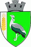 |
The name of the city comes from a local type of bird, called dropie (English: great bustard).
Drochia is first mentioned by chroniclers in 1777. By 1830 it was a small settlement encompassing 25 families. A document dating from 1847 notes that a small grape-processing plant, the town's first industrial enterprise, had been built. Two mills situated on a local stream were built in 1875.
More intensive industrial development emerged after the railway first came through at the end of the 19th century. At the 1930 census, the locality (then a village) was known as Drochia-Gară (literally Drochia Station), and had a population of only 595. It was part of Plasa Bădiceni of the Soroca County.
Drochia received the status of a city in 1973.
Map - Drochia
Map


Country - Moldova
 |
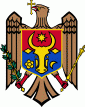 |
| Flag of Moldova | |
Most of Moldovan territory was a part of the Principality of Moldavia from the 14th century until 1812, when it was ceded to the Russian Empire by the Ottoman Empire (to which Moldavia was a vassal state) and became known as Bessarabia. In 1856, southern Bessarabia was returned to Moldavia, which three years later united with Wallachia to form Romania, but Russian rule was restored over the whole of the region in 1878. During the 1917 Russian Revolution, Bessarabia briefly became an autonomous state within the Russian Republic. In February 1918, it declared independence and then integrated into Romania later that year following a vote of its assembly. The decision was disputed by Soviet Russia, which in 1924 established, within the Ukrainian SSR, a so-called Moldavian autonomous republic on partially Moldovan-inhabited territories to the east of Bessarabia.
Currency / Language
| ISO | Currency | Symbol | Significant figures |
|---|---|---|---|
| MDL | Moldovan leu | L | 2 |
| ISO | Language |
|---|---|
| RO | Romanian language |
| RU | Russian language |
| TR | Turkish language |