Dili District (Díli)
 |
Several explanations have been proffered for the origin of the municipality's name. It is often explained, including by the municipality's own website, as being derived from the Tetum word ai-dila, which means pawpaw. According to Australian linguist, ethnologist and historian Geoffrey Hull, however, that explanation is phonologically and historically implausible, as the language spoken in the area now known as Dili before the Portuguese established their seat of administration there in 1769 was Mambai, not Tetum. Hull describes such explanations as "folk etymology".
In Hull's view, the word Dili appears to be cognate with the Bunak word zili, a reference to the escarpment behind the city; he comments that a Papuan language, of which Bunak is an example, was spoken in the Dili area before the spread of the Austronesian-based Mambai and Tetum languages.
Another "folk etymology" explanation suggested by the municipality is that its name is derived from the Portuguese word Dali, which, in turn, is an approximation of the Tetum expression tali akar. According to the municipality, there were lots of hemp trees in what is now the suco of Caicoli at the centre of the then Reino Motaain, which covered present day Dili. Every year, the local community held a traditional dance ceremony, and also offered sacrifices for the hemp tree. The local people believed that the Portuguese word Dali meant 'sacred eye', and so they adopted it as the area's name.
Map - Dili District (Díli)
Map


Country - East_Timor
 |
 |
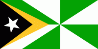
| Flag of East Timor | |
East Timor came under Portuguese influence in the sixteenth century, remaining a Portuguese colony until 1975. Internal conflict preceded a unilateral declaration of independence and an Indonesian invasion and annexation. Resistance continued throughout Indonesian rule, and in 1999 a United Nations–sponsored act of self-determination led to Indonesia relinquishing control of the territory. On 20 May 2002, as Timor-Leste, it became the first new sovereign state of the 21st century. That same year, relations with Indonesia were established and normalized, with Indonesia also supporting East Timor's accession into ASEAN.
Currency / Language
| ISO | Currency | Symbol | Significant figures |
|---|---|---|---|
| USD | United States dollar | $ | 2 |
| ISO | Language |
|---|---|
| EN | English language |
| ID | Indonesian language |
| PT | Portuguese language |