Damara (Damara)
Damara is a town located in the Central African Republic prefecture of Ombella-M'Poko. It is located about an hour from the national capital, Bangui.
In March 2013, rebels from the Séléka Coalition (Séléka means "alliance" in the Sango language) overtook a checkpoint in Damara. Part of the 2012-2013 Central African Republic conflict, the rebels claimed that President of the Central African Republic François Bozizé had violated the terms of a January cease-fire agreement. After storming the Damara checkpoint, however, the rebels were prevented from taking Bangui by a helicopter attack. "The helicopter opened fire on the column, forcing it to disperse... The rebels have not reached Bangui," said a senior military analyst quoted by Reuters.
In March 2013, rebels from the Séléka Coalition (Séléka means "alliance" in the Sango language) overtook a checkpoint in Damara. Part of the 2012-2013 Central African Republic conflict, the rebels claimed that President of the Central African Republic François Bozizé had violated the terms of a January cease-fire agreement. After storming the Damara checkpoint, however, the rebels were prevented from taking Bangui by a helicopter attack. "The helicopter opened fire on the column, forcing it to disperse... The rebels have not reached Bangui," said a senior military analyst quoted by Reuters.
Map - Damara (Damara)
Map
Country - Central_African_Republic
 |
 |
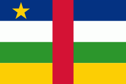
| Flag of the Central African Republic | |
The Central African Republic covers a land area of about 620000 km2. , it had an estimated population of around million. , the Central African Republic is the scene of a civil war, which is ongoing since 2012.
Currency / Language
| ISO | Currency | Symbol | Significant figures |
|---|---|---|---|
| XAF | Central African CFA franc | Fr | 0 |
| ISO | Language |
|---|---|
| FR | French language |
| KG | Kongo language |
| LN | Lingala language |
| SG | Sango language |


