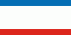
Crimea (Autonomous Republic of Crimea)
 |
 |
Crimea (called the Tauric Peninsula until the early modern period) has historically been at the boundary between the classical world and the steppe. Greeks colonized its southern fringe and were absorbed by the Roman and Byzantine Empires and successor states while remaining culturally Greek. Some cities became trading colonies of Genoa, until conquered by the Ottoman Empire. Throughout this time the interior was occupied by a changing cast of steppe nomads. In the 14th century it became part of the Golden Horde; the Crimean Khanate emerged as a successor state. In the 15th century, the Khanate became a dependency of the Ottoman Empire. Russia was often the target of slave raids during this period. In 1783, the Russian Empire annexed Crimea after an earlier war with Turkey. Crimea's strategic position led to the 1854 Crimean War and many short lived regimes following the 1917 Russian Revolution. When the Bolsheviks secured Crimea it became an autonomous soviet republic within Russia. During World War II, Crimea was downgraded to an oblast. In 1944 Crimean Tatars were ethnically cleansed and deported under the orders of Joseph Stalin, in what has been described as a cultural genocide. The USSR transferred Crimea to Ukraine on the 300th anniversary of the Pereyaslav Treaty in 1954.
After Ukrainian independence in 1991 the central government and Crimea clashed, with the region being granted more autonomy. The Soviet fleet in Crimea was also in contention but a 1997 treaty allowed Russia to continue basing its fleet in Sevastopol. In 2014, the Russians occupied the peninsula and organized an illegal referendum in support of Russian annexation, but most countries recognize Crimea as Ukrainian territory.
The classical name for Crimea, Tauris or Taurica, is from the Greek Ταυρική (Taurikḗ), after the peninsula's Scytho-Cimmerian inhabitants, the Tauri. Today, the Crimean Tatar name of the peninsula is Qırım, while the Russian is Крым (Krym), and the Ukrainian is Крим (Krym).
Strabo (Geography vii 4.3, xi. 2.5), Polybius, (Histories 4.39.4), and Ptolemy (Geographia. II, v 9.5) refer variously to the Strait of Kerch as the Κιμμερικὸς Βόσπορος (Kimmerikos Bosporos, romanized spelling, Bosporus Cimmerius), its easternmost part as the Κιμμέριον Ἄκρον (Kimmerion Akron, Roman name: Promontorium Cimmerium), as well as to the city of Cimmerium and thence the name of the Kingdom of the Cimmerian Bosporus (Κιμμερικοῦ Βοσπόρου).
The city Staryi Krym ('Old Crimea'), served as a capital of the Crimean province of the Golden Horde. Between 1315 and 1329 CE, the Arab writer Abū al-Fidā recounted a political fight in 1300–1301 CE which resulted in a rival's decapitation and his head being sent "to the Crimea", apparently in reference to the peninsula, although some sources hold that the name of the capital was extended to the entire peninsula at some point during Ottoman suzerainty (1441–1783).
The origin of the word Qırım is uncertain. Suggestions argued in various sources include:
* 1) a corruption of Cimmerium (Greek, Kimmerikon, Κιμμερικόν).
* 2) a derivation from the Turkic term qirum ("fosse, trench"), from qori- ("to fence, protect").
Other suggestions either unsupported or contradicted by sources, apparently based on similarity in sound, include:
Map - Crimea (Autonomous Republic of Crimea)
Map
Country - Ukraine
 |
 |
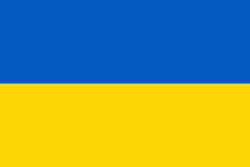
| Flag of Ukraine | |
During the Middle Ages, Ukraine was the site of early Slavic expansion and the area later became a key centre of East Slavic culture under the state of Kievan Rus', which emerged in the 9th century. The state eventually disintegrated into rival regional powers and was ultimately destroyed by the Mongol invasions of the 13th century. The area was then contested, divided, and ruled by a variety of external powers for the next 600 years, including the Polish–Lithuanian Commonwealth, the Austrian Empire, the Ottoman Empire, and the Tsardom of Russia. The Cossack Hetmanate emerged in central Ukraine in the 17th century, but was partitioned between Russia and Poland, and ultimately absorbed by the Russian Empire. Ukrainian nationalism developed, and following the Russian Revolution in 1917, the short-lived Ukrainian People's Republic was formed. The Bolsheviks consolidated control over much of the former empire and established the Ukrainian Soviet Socialist Republic, which became a constituent republic of the Soviet Union when it was formed in 1922. In the early 1930s, millions of Ukrainians died in the Holodomor, a man-made famine. During World War II, Ukraine was devastated by the German occupation.
Currency / Language
| ISO | Currency | Symbol | Significant figures |
|---|---|---|---|
| UAH | Ukrainian hryvnia | â‚´ | 2 |
| ISO | Language |
|---|---|
| HU | Hungarian language |
| PL | Polish language |
| RU | Russian language |
| UK | Ukrainian language |


