Cocos (Cocos Island Airport)
Cocos (Keeling) Islands Airport (Lapangan Terbang Pulu Koko (Keeling)) is an airport serving the Cocos (Keeling) Islands, a territory of Australia located in the Indian Ocean. The airport is on West Island, one of the South Keeling Islands and capital of the territory.
The airfield was built during World War II to support Allied aircraft in the war against Japan. Two airstrips were built, and three bomber squadrons were moved to the islands to conduct raids against Japanese targets in Southeast Asia and to provide support during the planned re-invasion of Malaya and reconquest of Singapore. The first aircraft to arrive were Supermarine Spitfire Mk VIIIs of No. 136 Squadron RAF. They included some B-24 Liberator bombers from No. 321 (Netherlands) Squadron RAF (members of exiled Dutch forces serving with the Royal Air Force), which were also stationed on the islands.
The airfield was built during World War II to support Allied aircraft in the war against Japan. Two airstrips were built, and three bomber squadrons were moved to the islands to conduct raids against Japanese targets in Southeast Asia and to provide support during the planned re-invasion of Malaya and reconquest of Singapore. The first aircraft to arrive were Supermarine Spitfire Mk VIIIs of No. 136 Squadron RAF. They included some B-24 Liberator bombers from No. 321 (Netherlands) Squadron RAF (members of exiled Dutch forces serving with the Royal Air Force), which were also stationed on the islands.
Map - Cocos (Cocos Island Airport)
Map
Country - Cocos_(Keeling)_Islands
 |
 |
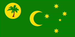
The territory consists of two atolls made up of 27 coral islands, of which only two – West Island and Home Island – are inhabited. The population of around 600 people consists mainly of Cocos Malays, who mostly practice Sunni Islam and speak a dialect of Malay as their first language. The territory is administered by the Australian federal government's Department of Infrastructure, Transport, Regional Development and Communications as an Australian external territory and together with Christmas Island (which is about 960 km to the east) forms the Australian Indian Ocean Territories administrative grouping. However, the islanders do have a degree of self-government through the local shire council. Many public services – including health, education, and policing – are provided by the state of Western Australia, and Western Australian law applies except where the federal government has determined otherwise. The territory also uses Western Australian postcodes.
Currency / Language
| ISO | Currency | Symbol | Significant figures |
|---|---|---|---|
| AUD | Australian dollar | $ | 2 |
| ISO | Language |
|---|---|
| EN | English language |
| MS | Malay language |


