Cobija
Cobija is a city in Bolivia, capital of the department of Pando, is located about 600 km (373 mi.) north of La Paz in the Amazon Basin on the border with Brazil. Cobija lies on the banks of the Rio Acre across from the Brazilian city of Brasiléia. Cobija lies at an elevation of ca. 280 m (920 ft.) above sea level and has a tropical and rainy climate.
Cobija has approximately 80,000 inhabitants, is the seat of a university and capital of the Bolivian Pando Department. Cobija has two airports and is connected by one road to El Choro in the Beni Department, which is not always passable during the rainy season. When the rain allows it, Cobija is connected to the rest of Bolivia also via road. Cobija is connected to Brazil by two bridges.
Cobija was founded in 1906 by Colonel Enrique Cornejo, originally under the name of Bahía and received its current name in 1908 in commemoration of the former Bolivian seaport Cobija on the Pacific, which has been a part of Chile since the War of the Pacific. In the early 1900s, Cobija experienced a boom as an India rubber industry center. When the industry collapsed, a major source of income being lost, Cobija became impoverished and its population fell. Nowadays, Cobija is developing again and its population is increasing. Currently, the region's primary industry is Bolivia nuts, although tourism and commerce are growing. There is a Free economic zone in the city, the largest in Bolivia.
Map - Cobija
Map
Country - Bolivia
 |
 |
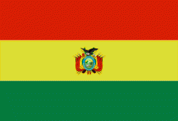
| Flag of Bolivia | |
The sovereign state of Bolivia is a constitutionally unitary state, divided into nine departments. Its geography varies from the peaks of the Andes in the West, to the Eastern Lowlands, situated within the Amazon basin. One-third of the country is within the Andean mountain range. With 1098581 km2 of area, Bolivia is the fifth largest country in South America, after Brazil, Argentina, Peru, and Colombia (and alongside Paraguay, one of the only two landlocked countries in the Americas), the 27th largest in the world, the largest landlocked country in the Southern Hemisphere, and the world's seventh largest landlocked country, after Kazakhstan, Mongolia, Chad, Niger, Mali, and Ethiopia.
Currency / Language
| ISO | Currency | Symbol | Significant figures |
|---|---|---|---|
| BOB | Boliviano | Bs | 2 |
| ISO | Language |
|---|---|
| AY | Aymara language |
| QU | Quechua language |
| ES | Spanish language |


