Map - Chontales Department (Departamento de Chontales)

Chontales Department (Departamento de Chontales)
Chontales (Departamento de Chontales) is a department in Nicaragua. It covers an area of 6,481 km² and has a population of 191,856. The capital is Juigalpa. Some 90 km of land overlooks Lake Cocibolca (Lake Nicaragua) on the western side. The department is livestock and fishing based, and is also a producer of apples.

The Chontales Department is situated in the central-southwest part of the country. It is bordered by the Boaco Department to the north, the Río San Juan Department to the south, the South Caribbean Coast Autonomous Region to the east and Lake Cocibolca to the west. Chontales geographically primarily consists of the slopes around Lake Cocibolca, the Serranía Chontaleña range and rolling hills that undulate towards the Caribbean plain. The Cuisalá, a tributary of the Mayales flows in the northwestern part of the department. The shoreline of Lake Cocibolca within the department is about 90 km, between the mouths of the Tecolostote and Oyate rivers.

 
Map - Chontales Department (Departamento de Chontales)
Country - Nicaragua
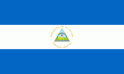
Flag of Nicaragua
Nicaragua, officially the Republic of Nicaragua , is the largest country in Central America, bordered by Honduras to the north, the Caribbean to the east, Costa Rica to the south, and the Pacific Ocean to the west. Managua is the country's capital and largest city. , it was estimated to be the second largest city in Central America. Nicaragua's multiethnic population of six million includes people of mestizo, Indigenous, European and African heritage. The main language is Spanish. Indigenous tribes on the Mosquito Coast speak their own languages and English.

Originally inhabited by various indigenous cultures since ancient times, the region was conquered by the Spanish Empire in the 16th century. Nicaragua gained independence from Spain in 1821. The Mosquito Coast followed a different historical path, being colonized by the English in the 17th century and later coming under British rule. It became an autonomous territory of Nicaragua in 1860 and its northernmost part was transferred to Honduras in 1960. Since its independence, Nicaragua has undergone periods of political unrest, dictatorship, occupation and fiscal crisis, including the Nicaraguan Revolution of the 1960s and 1970s and the Contra War of the 1980s.
Currency / Language  
ISO Currency Symbol Significant figures
NIO Nicaraguan córdoba C$ 2
Neighbourhood - Country  
  •  Costa rica 
  •  Honduras