Chibombo District (Chibombo District)
Chibombo District is a district of Central Province, Zambia. As of the 2010 Zambian Census, the district had a population of 293,765 people. It consists of two constituencies, namely Keembe and Katuba.
Its headquarters are at Chibombo, and it lies between the Lukanga Swamp in the west and the end of the Luangwa Valley in the east. It includes good commercial farmland north of Lusaka. Most of the people occupying this place are low-scale commercial farmers. Chibombo has attracted the interest of people from more developed areas of the country like Lusaka, and the Copperbelt provinces.
The area is seeing a lot of development in recent times. A village in Chibombo called Chipansha has seen a lot invested in the education of its young boys and girls with the installment of an orphanage.
An organisation called Our Moon Education has also set up its headquarters in the area. Its students offer a lot of teaching to the local pupils. The sparsely populated district still recognises a traditional hierarchy of leadership. They have a Chief and many Headmen who look after the smaller constituent villages.
* Our Moon Education
Map - Chibombo District (Chibombo District)
Map
Country - Zambia
 |
 |
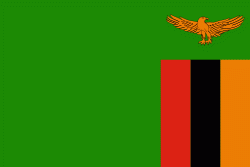
| Flag of Zambia | |
The region was affected by the Bantu expansion of the 13th century. Following the arrival of European explorers in the 18th century, the British colonised the region into the British protectorates of Barotseland-North-Western Rhodesia and North-Eastern Rhodesia comprising 73 tribes, towards the end of the 19th century. These were merged in 1911 to form Northern Rhodesia. For most of the colonial period, Zambia was governed by an administration appointed from London with the advice of the British South Africa Company. On 24 October 1964, Zambia became independent of the United Kingdom and prime minister Kenneth Kaunda became the inaugural president. From 1972 to 1991 Zambia was a one-party state with the United National Independence Party as the sole legal political party under the motto "One Zambia, One Nation" coined by Kaunda. Kaunda was succeeded by Frederick Chiluba of the social-democratic Movement for Multi-Party Democracy in 1991, beginning a period of government decentralisation.
Currency / Language
| ISO | Currency | Symbol | Significant figures |
|---|---|---|---|
| ZMW | Zambian kwacha | ZK | 2 |
| ISO | Language |
|---|---|
| NY | Chichewa language |
| EN | English language |


