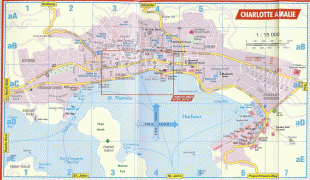
Charlotte Amalie (Charlotte Amalie)
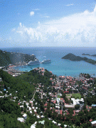
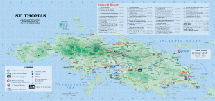
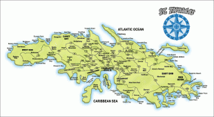
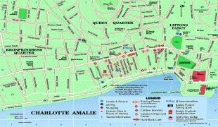
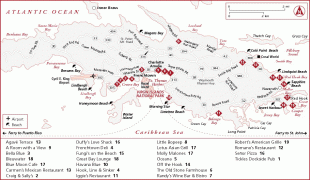
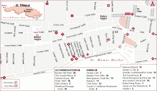
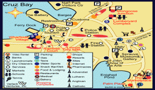
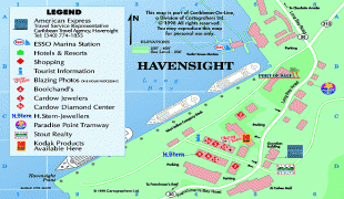
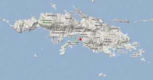
Charlotte Amalie, located on St. Thomas, is the capital and the largest city of the United States Virgin Islands. It was founded in 1666 as Taphus (meaning 'beer house' or 'beer hall' in Danish). In 1691, the town was renamed to Charlotte Amalie after Charlotte Amalie of Hesse-Kassel (1650–1714), queen consort to King Christian V of Denmark-Norway. It has a deep-water harbor that was once a haven for pirates and is now one of the busiest ports of call for cruise ships in the Caribbean, with about 1.5 million-plus cruise ship passengers landing there annually. Protected by Hassel Island, the harbor has docking and fueling facilities, machine shops, and shipyards and was a U.S. submarine base until 1966. The Town has been inhabited for centuries. When Christopher Columbus arrived in 1493, the area was inhabited by Caribs, Arawaks, Ciboney and Taíno native peoples. It is on the southern shore at the head of Saint Thomas Harbor. In 2010 the City had a population of 18,481, which makes it the largest city in the Virgin Islands Archipelago. Hundreds of ferries and yachts pass by the Town each week.
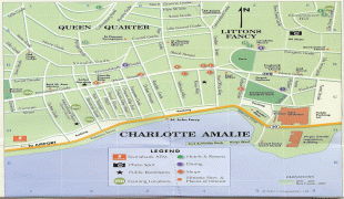
The City is known for its Danish colonial architecture, building structure and history. Dozens of streets and places throughout the City have Danish names. Charlotte Amalie has buildings of historical importance including St. Thomas Synagogue, the second oldest synagogue in the United States, and Frederick Lutheran Church. The Town has a long history of pirates, especially myths of Bluebeard, and facts and stories of Blackbeard (Edward Teach). In the 17th century, the Danes built both Blackbeard's Castle and Bluebeard's Castle attributed to the pirates. Blackbeard's Castle is a U.S. National Historic Landmark. Another tourist attraction is Fort Christian, the oldest standing structure in the Virgin Islands Archipelago. A copy of the Liberty Bell and freed slave blowing a conch shell are in Emancipation Park, which is both a source of national pride and a tourist attraction.
Before the time of the Danish West Indies (1754–1917), the City was known as Taphus for its many beer halls. Taphus is Danish and directly translates to 'beer house', 'beer hall', or (most literally) 'tap house'. In 1691 the Town received a more respectable name by being named Charlotte Amalie in honor of Danish King Christian V's wife, Charlotte Amalie of Hesse-Kassel (1650–1714). Between 1921 and 1936, the city was called St. Thomas by the United States. In 1936 the capital was recognized as Charlotte Amalie.
Map - Charlotte Amalie (Charlotte Amalie)
Map


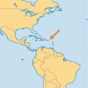
Country - United_States_Virgin_Islands
 |
 |
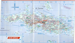
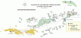
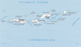
The U.S. Virgin Islands consist of the main islands of Saint Croix, Saint John, and Saint Thomas and 50 other surrounding minor islands and cays. The total land area of the territory is 133.73 sqmi. The territory's capital is Charlotte Amalie on the island of St. Thomas.
Currency / Language
| ISO | Currency | Symbol | Significant figures |
|---|---|---|---|
| USD | United States dollar | $ | 2 |
| ISO | Language |
|---|---|
| EN | English language |