Central Abaco (Central Abaco District)
Central Abaco is one of the districts of the Bahamas, in the Abaco Islands. The district contains the largest town in the Abacos, Marsh Harbour, which is the commerce centre for the islands. Some of the more noticeable settlements are:
* Little Harbour
* Lake City
* Spring City
* Marsh Harbour
* Dundas Town
The Local Government for this district is based in Marsh Harbour which is also one of the three Town Areas (the others being Murphy Town Township and Dundas Town Township).
* Little Harbour
* Lake City
* Spring City
* Marsh Harbour
* Dundas Town
The Local Government for this district is based in Marsh Harbour which is also one of the three Town Areas (the others being Murphy Town Township and Dundas Town Township).
Map - Central Abaco (Central Abaco District)
Map


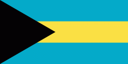
Country - The_Bahamas
 |
 |
The Bahama Islands were inhabited by the Lucayans, a branch of the Arawakan-speaking Taíno, for many centuries. Christopher Columbus was the first European to see the islands, making his first landfall in the "New World" in 1492 when he landed on the island of San Salvador. Later, the Spanish shipped the native Lucayans to and enslaved them on Hispaniola, after which the Bahama islands were mostly deserted from 1513 until 1648, nearly all native Bahamians having been forcibly removed for enslavement or having died of diseases that Europeans brought to the islands. In 1649, English colonists from Bermuda, known as the Eleutheran Adventurers, settled on the island of Eleuthera.
Currency / Language
| ISO | Currency | Symbol | Significant figures |
|---|---|---|---|
| BSD | Bahamian dollar | $ | 2 |
| ISO | Language |
|---|---|
| EN | English language |