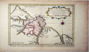
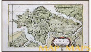
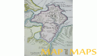
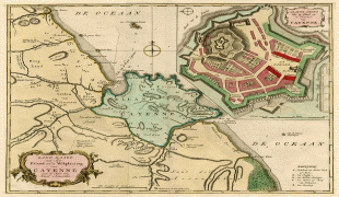
Cayenne
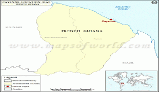
Cayenne (Kayenn) is the capital city of French Guiana, an overseas region and department of France located in South America. The city stands on a former island at the mouth of the Cayenne River on the Atlantic coast. The city's motto is "fert aurum industria", which means "work brings wealth". Cayenne is the largest francophone city of the South American continent.
In the 2020 census, there were 151,887 inhabitants in the metropolitan area of Cayenne (as defined by INSEE), 65,956 of whom lived in the city (commune) of Cayenne proper.
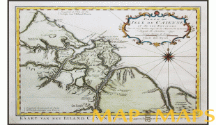
Ignored by Spanish explorers who found the region too hot and poor to be claimed, the region was not colonized until 1604, when the French founded a settlement. However, it was soon destroyed by the Portuguese, determined to enforce the Treaty of Tordesillas. French colonists returned in 1643 and founded Cayenne, but were forced to leave once more following the Amerindian attacks. In 1664, France finally established a permanent settlement at Cayenne. Over the next decade the colony changed hands between the French, Dutch, and English, before being restored to France. It was captured by an Anglo-Portuguese force in 1809 and administered from Brazil until 1814, when it was returned to French control. It was used as a French penal colony from 1854 to 1938. The city's population has grown dramatically over time, owing to high levels of immigration (chiefly from the West Indies and Brazil) as well as a high birth rate.
In the 2020 census, there were 151,887 inhabitants in the metropolitan area of Cayenne (as defined by INSEE), 65,956 of whom lived in the city (commune) of Cayenne proper.
Ignored by Spanish explorers who found the region too hot and poor to be claimed, the region was not colonized until 1604, when the French founded a settlement. However, it was soon destroyed by the Portuguese, determined to enforce the Treaty of Tordesillas. French colonists returned in 1643 and founded Cayenne, but were forced to leave once more following the Amerindian attacks. In 1664, France finally established a permanent settlement at Cayenne. Over the next decade the colony changed hands between the French, Dutch, and English, before being restored to France. It was captured by an Anglo-Portuguese force in 1809 and administered from Brazil until 1814, when it was returned to French control. It was used as a French penal colony from 1854 to 1938. The city's population has grown dramatically over time, owing to high levels of immigration (chiefly from the West Indies and Brazil) as well as a high birth rate.
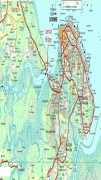
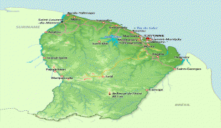
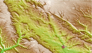
Map - Cayenne
Map


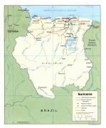

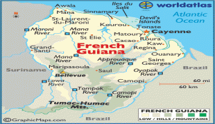
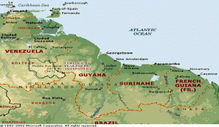
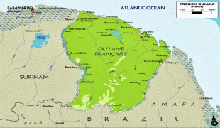

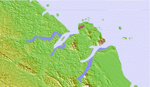
Country - French_Guiana
 |
 |
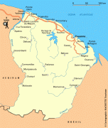
French Guiana is the second-largest region of France (more than one-seventh the size of Metropolitan France) and the largest outermost region within the European Union. It has a very low population density, with only 3.6 PD/sqkm. (Its population is less than 1⁄200 that of Metropolitan France.) Half of its 301,099 inhabitants in 2023 lived in the metropolitan area of Cayenne, its capital. 98.9% of the land territory of French Guiana is covered by forests, a large part of which is primeval rainforest. The Guiana Amazonian Park, which is the largest national park in the European Union, covers 41% of French Guiana's territory.
Currency / Language
| ISO | Currency | Symbol | Significant figures |
|---|---|---|---|
| EUR | Euro | € | 2 |
| ISO | Language |
|---|---|
| FR | French language |