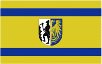
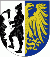
Bytom
 |
 |
It is one of the oldest cities in the Upper Silesia, and the former seat of the Piast dukes of the Duchy of Bytom. Until 1532, it was in the hands of the Piast dynasty, then it belonged to the Hohenzollern dynasty. After 1623 it was a state country in the hands of the Donnersmarck family. From 1742 to 1945 the town was within the borders of Prussia and Germany, and played an important role as an economic and administrative centre of the local industrial region. Until the outbreak of World War II, it was the main centre of national, social, cultural and publishing organisations fighting to preserve Polish identity in Upper Silesia. In the interbellum and during World War II, local Poles and Jews faced persecution by Germany.
After the war, decades of the Polish People's Republic were characterized by a constant emphasis on the development of heavy industry, which deeply polluted and degraded Bytom. After 1989, the city experienced a socio-economic decline. The population has also been rapidly declining since 1999. However, it is an important place in the cultural, entertainment, and industrial map of the region.
The bedrock of the Upland of Miechowice consists primarily of sandstones and slates. The rocks are punctuated with abundant natural resources of coal and iron ore from the Carboniferous period. In the north part of the upland, in the Bytom basin lays the broad range of the triassic rocks, from sandstones to limestones, with rich ore, zinc and lead reserves. The upper layer is composed of clay, sand and gravel.
Map - Bytom
Map
Country - Poland
 |
 |
| Flag of Poland | |
Poland has a temperate transitional climate and its territory traverses the Central European Plain, extending from Baltic Sea in the north to Sudeten and Carpathian Mountains in the south. The longest Polish river is the Vistula, and Poland's highest point is Mount Rysy, situated in the Tatra mountain range of the Carpathians. The country is bordered by Lithuania and Russia to the northeast, Belarus and Ukraine to the east, Slovakia and the Czech Republic to the south, and Germany to the west. It also shares maritime boundaries with Denmark and Sweden.
Currency / Language
| ISO | Currency | Symbol | Significant figures |
|---|---|---|---|
| PLN | Polish złoty | zÅ‚ | 2 |
| ISO | Language |
|---|---|
| PL | Polish language |


