Busan
 |
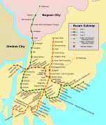
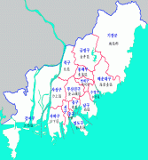
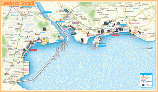
Busan is divided into 15 major administrative districts and a single county, together housing a population of approximately 3.6 million. The full metropolitan area, the Southeastern Maritime Industrial Region, has a population of approximately 8 million. The most densely built-up areas of the city are situated in a number of narrow valleys between the Nakdong and the Suyeong Rivers, with mountains separating most of the districts. The Nakdong is Korea's longest river and Busan's Haeundae Beach is also the country's largest.
Busan is a center for international conventions, hosting APEC in 2005. It is also a center for sports tournaments in Korea, having hosted the 2002 Asian Games and FIFA World Cup. It is home to the world's largest department store, the Shinsegae Centum City. Busan was added to the UNESCO Creative Cities Network as a "City of Film" in December 2014.
The name "Busan" is the Revised Romanization of the city's Korean name since the late 15th century. It officially replaced the earlier McCune-Reischauer romanization Pusan in 2000. During the Japanese period it was spelled "Fuzan".
The name (now written using the Korean alphabet) is Sino-Korean for "Cauldron Mountain", believed to be a former name of Mt Hwangryeong (,, Hwangryeong-san) west of the city center. The area's ancient state MtGeochil (거칠산국, 居柒山國, Geochilsan-guk, "Rough-Mountain Land") is similarly thought to refer to the same mountain, which towers over the town's harbor on the Suyeong. (The later Silla district of Geochilsan-gun was renamed Dongnae in 757.)
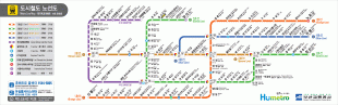
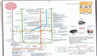
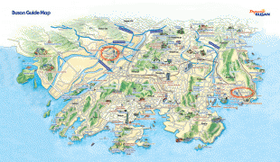
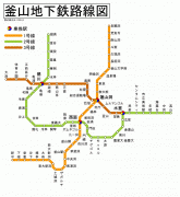
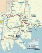
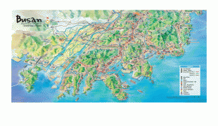
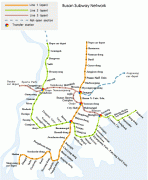
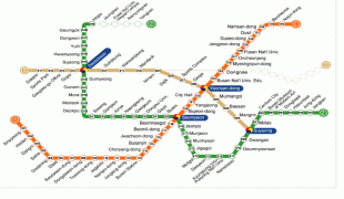
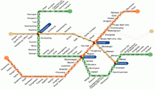
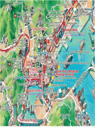
Map - Busan
Map


Country - South_Korea
 |
 |
| Flag of South Korea | |
The Korean Peninsula was inhabited as early as the Lower Paleolithic period. Its first kingdom was noted in Chinese records in the early 7th century BCE. Following the unification of the Three Kingdoms of Korea into Silla and Balhae in the late 7th century, Korea was ruled by the Goryeo dynasty (918–1392) and the Joseon dynasty (1392–1897). The succeeding Korean Empire (1897–1910) was annexed in 1910 into the Empire of Japan. Japanese rule ended following Japan's surrender in World War II, after which Korea was divided into two zones; a northern zone occupied by the Soviet Union and a southern zone occupied by the United States. After negotiations on reunification failed, the southern zone became the Republic of Korea in August 1948 while the northern zone became the communist Democratic People's Republic of Korea the following month.
Currency / Language
| ISO | Currency | Symbol | Significant figures |
|---|---|---|---|
| KRW | South Korean won | â‚© | 0 |
| ISO | Language |
|---|---|
| EN | English language |
| KO | Korean language |
