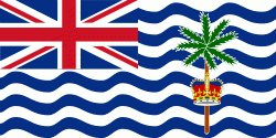
The British Indian Ocean Territory (BIOT) is an Overseas Territory of the United Kingdom situated in the Indian Ocean, halfway between Tanzania and Indonesia. The territory comprises the seven atolls of the Chagos Archipelago with over 1,000 individual islands – many very small – amounting to a total land area of 60 km2. The largest and most southerly island is Diego Garcia, 27 km2, the site of a Joint Military Facility of the United Kingdom and the United States.
The only inhabitants are British and United States military personnel, and associated contractors, who collectively number around 3,000 (2018 figures). The forced removal of Chagossians from the Chagos Archipelago occurred between 1968 and 1973. The Chagossians, then numbering about 2,000 people, were expelled by the UK government to Mauritius and Seychelles in order to construct the military base. Today, the exiled Chagossians are still trying to return, saying that the forced expulsion and dispossession was unlawful, but the UK government has repeatedly denied them the right of return. The islands are off-limits to Chagossians, tourists, and the media.


